
U42A Revenden, AR, USA - Earthquake Result Viewer
| ||||||||||||||||||
| ||||||||||||||||||
| ||||||||||||||||||
|
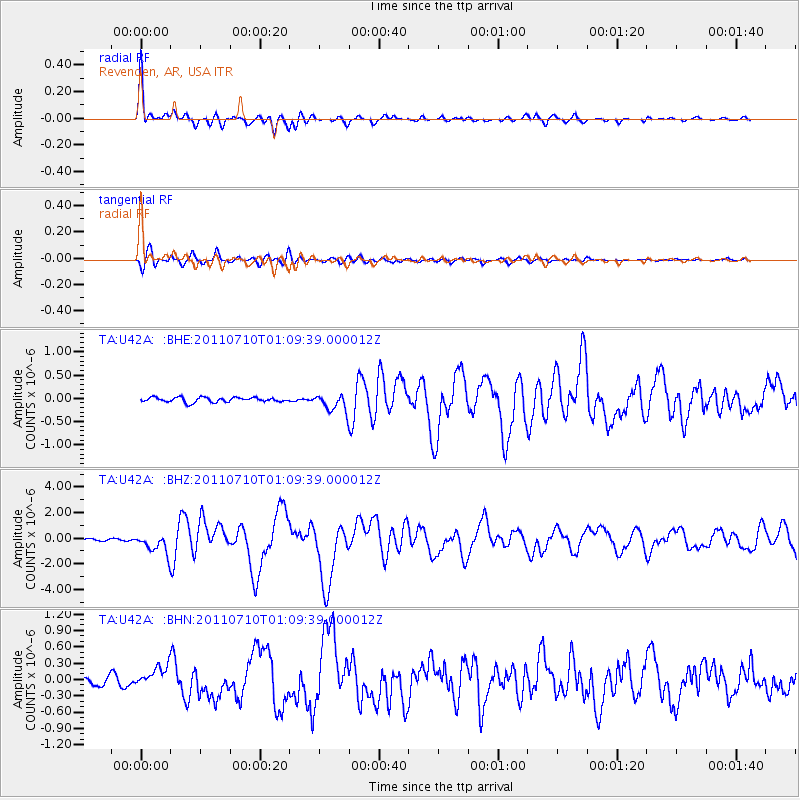
Signal To Noise
| Channel | StoN | STA | LTA |
| TA:U42A: :BHZ:20110710T01:09:39.000012Z | 10.958039 | 7.583018E-7 | 6.92005E-8 |
| TA:U42A: :BHN:20110710T01:09:39.000012Z | 2.4716175 | 1.9799523E-7 | 8.010756E-8 |
| TA:U42A: :BHE:20110710T01:09:39.000012Z | 3.7541835 | 1.8976509E-7 | 5.0547634E-8 |
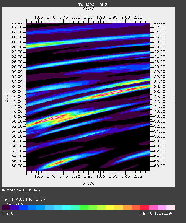
| Arrivals | |
| Ps | 5.4 SECOND |
| PpPs | 20 SECOND |
| PsPs/PpSs | 25 SECOND |

