U41A Viola, AR, USA - Earthquake Result Viewer
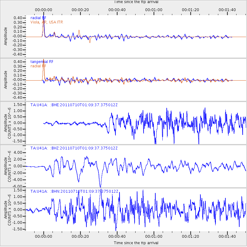
Earthquake location: Off East Coast Of Honshu, Japan
Earthquake latitude/longitude: 38.0/143.3
Earthquake time(UTC): 2011/07/10 (191) 00:57:10 GMT
Earthquake Depth: 23 km
Earthquake Magnitude: 6.6 MB, 7.0 MS, 7.0 MW, 7.0 MW
Earthquake Catalog/Contributor: WHDF/NEIC
Network: TA USArray Transportable Network (new EarthScope stations)
Station: U41A Viola, AR, USA
Lat/Lon: 36.34 N/91.92 W
Elevation: 300 m
Distance: 90.1 deg
Az: 41.517 deg
Baz: 319.587 deg
Ray Param: 0.04169444
Estimated Moho Depth: 39.0 km
Estimated Crust Vp/Vs: 1.76
Assumed Crust Vp: 6.53 km/s
Estimated Crust Vs: 3.705 km/s
Estimated Crust Poisson's Ratio: 0.26
Radial Match: 95.427505 %
Radial Bump: 350
Transverse Match: 86.106125 %
Transverse Bump: 400
SOD ConfigId: 395004
Insert Time: 2011-12-16 07:09:35.811 +0000
GWidth: 2.5
Max Bumps: 400
Tol: 0.001

Signal To Noise

ChannelStoNSTALTA
TA:U41A: :BHZ:20110710T01:09:37.375012Z11.5009019.343001E-78.123712E-8
TA:U41A: :BHN:20110710T01:09:37.375012Z3.16889362.779067E-78.769834E-8
TA:U41A: :BHE:20110710T01:09:37.375012Z3.2024112.1289972E-76.648108E-8
Arrivals
Ps4.7 SECOND
PpPs16 SECOND
PsPs/PpSs21 SECOND