LTY Liberty (broad-band) - Earthquake Result Viewer
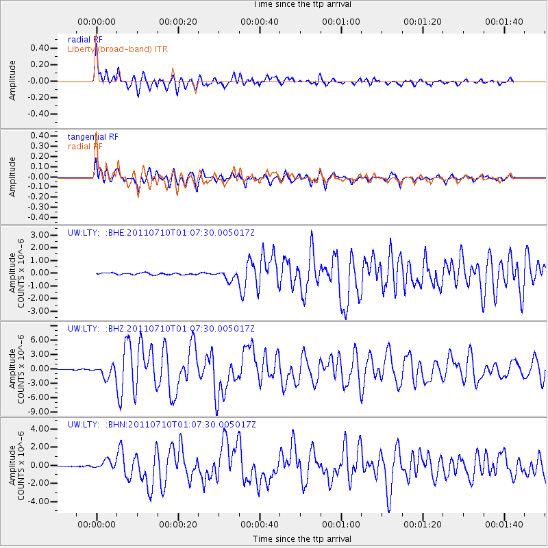
Earthquake location: Off East Coast Of Honshu, Japan
Earthquake latitude/longitude: 38.0/143.3
Earthquake time(UTC): 2011/07/10 (191) 00:57:10 GMT
Earthquake Depth: 23 km
Earthquake Magnitude: 6.6 MB, 7.0 MS, 7.0 MW, 7.0 MW
Earthquake Catalog/Contributor: WHDF/NEIC
Network: UW Pacific Northwest Regional Seismic Network
Station: LTY Liberty (broad-band)
Lat/Lon: 47.26 N/120.66 W
Elevation: 970 m
Distance: 66.9 deg
Az: 47.425 deg
Baz: 301.389 deg
Ray Param: 0.057279427
Estimated Moho Depth: 48.0 km
Estimated Crust Vp/Vs: 1.72
Assumed Crust Vp: 6.597 km/s
Estimated Crust Vs: 3.847 km/s
Estimated Crust Poisson's Ratio: 0.24
Radial Match: 92.54263 %
Radial Bump: 400
Transverse Match: 89.775986 %
Transverse Bump: 400
SOD ConfigId: 395004
Insert Time: 2011-12-16 07:11:15.483 +0000
GWidth: 2.5
Max Bumps: 400
Tol: 0.001

Signal To Noise

ChannelStoNSTALTA
UW:LTY: :BHZ:20110710T01:07:30.005017Z24.1431711.3154852E-65.4486843E-8
UW:LTY: :BHN:20110710T01:07:30.005017Z10.9165415.1096237E-74.6806253E-8
UW:LTY: :BHE:20110710T01:07:30.005017Z5.69562633.815688E-76.69933E-8
Arrivals
Ps5.4 SECOND
PpPs19 SECOND
PsPs/PpSs24 SECOND