FISH Seaside, OR, USA - Earthquake Result Viewer
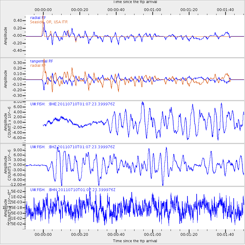
Earthquake location: Off East Coast Of Honshu, Japan
Earthquake latitude/longitude: 38.0/143.3
Earthquake time(UTC): 2011/07/10 (191) 00:57:10 GMT
Earthquake Depth: 23 km
Earthquake Magnitude: 6.6 MB, 7.0 MS, 7.0 MW, 7.0 MW
Earthquake Catalog/Contributor: WHDF/NEIC
Network: UW Pacific Northwest Regional Seismic Network
Station: FISH Seaside, OR, USA
Lat/Lon: 45.93 N/123.56 W
Elevation: 325 m
Distance: 65.9 deg
Az: 49.783 deg
Baz: 300.237 deg
Ray Param: 0.057961997
Estimated Moho Depth: 11.0 km
Estimated Crust Vp/Vs: 1.61
Assumed Crust Vp: 6.566 km/s
Estimated Crust Vs: 4.091 km/s
Estimated Crust Poisson's Ratio: 0.18
Radial Match: 83.95819 %
Radial Bump: 400
Transverse Match: 84.00434 %
Transverse Bump: 400
SOD ConfigId: 395004
Insert Time: 2011-12-16 07:12:11.467 +0000
GWidth: 2.5
Max Bumps: 400
Tol: 0.001

Signal To Noise

ChannelStoNSTALTA
UW:FISH: :BHZ:20110710T01:07:23.399976Z5.85906551.4803488E-62.5265953E-7
UW:FISH: :BHN:20110710T01:07:23.399976Z0.986163145.705582E-95.785637E-9
UW:FISH: :BHE:20110710T01:07:23.399976Z0.331863643.7404084E-71.1270919E-6
Arrivals
Ps1.1 SECOND
PpPs4.2 SECOND
PsPs/PpSs5.2 SECOND