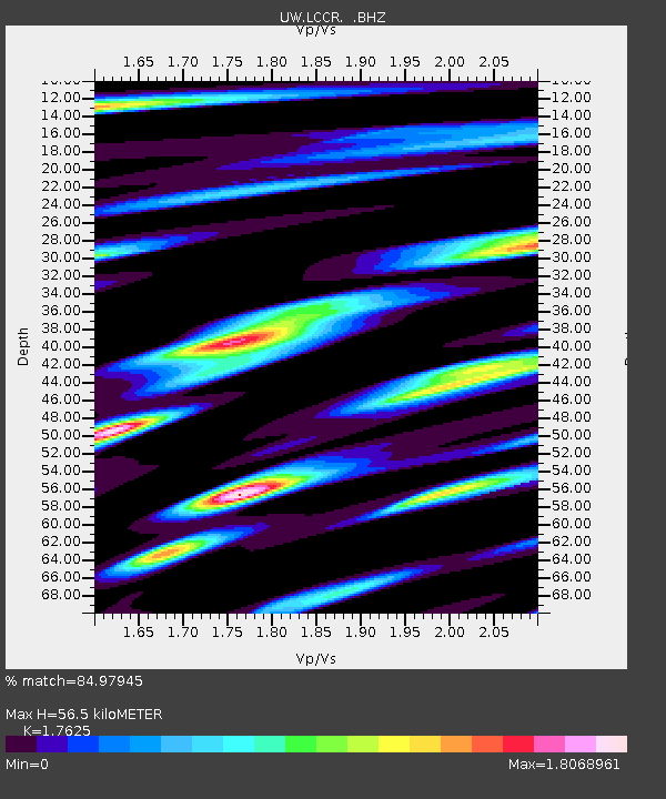
LCCR Mulino, OR, USA - Earthquake Result Viewer
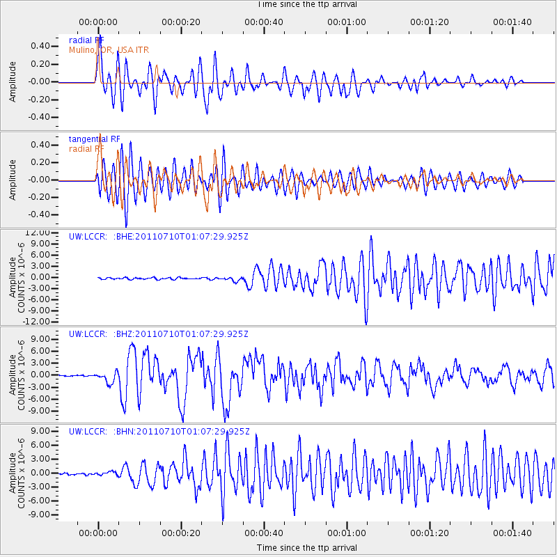
Earthquake location: Off East Coast Of Honshu, Japan
Earthquake latitude/longitude: 38.0/143.3
Earthquake time(UTC): 2011/07/10 (191) 00:57:10 GMT
Earthquake Depth: 23 km
Earthquake Magnitude: 6.6 MB, 7.0 MS, 7.0 MW, 7.0 MW
Earthquake Catalog/Contributor: WHDF/NEIC
Network: UW Pacific Northwest Regional Seismic Network
Station: LCCR Mulino, OR, USA
Lat/Lon: 45.21 N/122.48 W
Elevation: 273 m
Distance: 66.9 deg
Az: 50.041 deg
Baz: 301.11 deg
Ray Param: 0.05728789
Estimated Moho Depth: 56.5 km
Estimated Crust Vp/Vs: 1.76
Assumed Crust Vp: 6.566 km/s
Estimated Crust Vs: 3.725 km/s
Estimated Crust Poisson's Ratio: 0.26
Radial Match: 84.97945 %
Radial Bump: 400
Transverse Match: 82.70086 %
Transverse Bump: 400
SOD ConfigId: 395004
Insert Time: 2011-12-16 07:12:26.880 +0000
GWidth: 2.5
Max Bumps: 400
Tol: 0.001

Signal To Noise

ChannelStoNSTALTA
UW:LCCR: :BHZ:20110710T01:07:29.925Z16.7403621.4159381E-68.458228E-8
UW:LCCR: :BHN:20110710T01:07:29.925Z2.09738164.0115842E-71.912663E-7
UW:LCCR: :BHE:20110710T01:07:29.925Z2.43625645.243542E-72.1522949E-7
Arrivals
Ps6.8 SECOND
PpPs23 SECOND
PsPs/PpSs30 SECOND