You are here: Home > Network List > UW - Pacific Northwest Regional Seismic Network Stations List
> Station MEGW Megler, WA CREST BB SMO > Earthquake Result Viewer
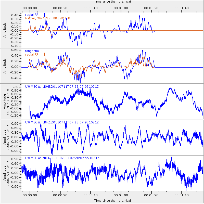
MEGW Megler, WA CREST BB SMO - Earthquake Result Viewer
*The percent match for this event was below the threshold and hence no stack was calculated.
| Earthquake location: |
Kermadec Islands Region |
| Earthquake latitude/longitude: |
-29.5/-176.6 |
| Earthquake time(UTC): |
2011/07/11 (192) 07:15:43 GMT |
| Earthquake Depth: |
11 km |
| Earthquake Magnitude: |
5.5 MB, 6.0 MS, 6.1 MW, 5.9 MW |
| Earthquake Catalog/Contributor: |
WHDF/NEIC |
|
| Network: |
UW Pacific Northwest Regional Seismic Network |
| Station: |
MEGW Megler, WA CREST BB SMO |
| Lat/Lon: |
46.27 N/123.88 W |
| Elevation: |
332 m |
|
| Distance: |
89.2 deg |
| Az: |
33.498 deg |
| Baz: |
223.919 deg |
| Ray Param: |
$rayparam |
*The percent match for this event was below the threshold and hence was not used in the summary stack. |
|
| Radial Match: |
50.312695 % |
| Radial Bump: |
206 |
| Transverse Match: |
61.50412 % |
| Transverse Bump: |
230 |
| SOD ConfigId: |
395004 |
| Insert Time: |
2011-12-16 07:35:05.895 +0000 |
| GWidth: |
2.5 |
| Max Bumps: |
400 |
| Tol: |
0.001 |
|
Signal To Noise
| Channel | StoN | STA | LTA |
| UW:MEGW: :BHZ:20110711T07:28:07.951021Z | 1.2341113 | 3.224377E-7 | 2.6127117E-7 |
| UW:MEGW: :BHN:20110711T07:28:07.951021Z | 1.082174 | 2.3374173E-7 | 2.1599276E-7 |
| UW:MEGW: :BHE:20110711T07:28:07.951021Z | 1.9579796 | 1.2163879E-6 | 6.2124644E-7 |
| Arrivals |
| Ps | |
| PpPs | |
| PsPs/PpSs | |


