You are here: Home > Network List > CI - Caltech Regional Seismic Network Stations List
> Station DAN Danby, California, USA > Earthquake Result Viewer
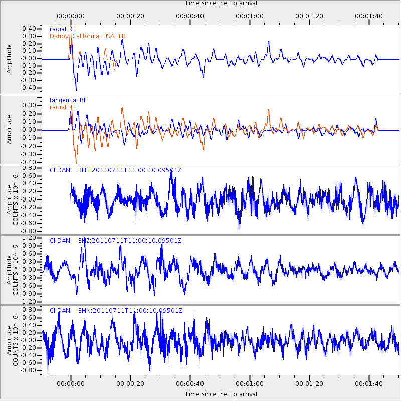
DAN Danby, California, USA - Earthquake Result Viewer
*The percent match for this event was below the threshold and hence no stack was calculated.
| Earthquake location: |
Tonga Islands Region |
| Earthquake latitude/longitude: |
-22.7/-174.7 |
| Earthquake time(UTC): |
2011/07/11 (192) 10:48:32 GMT |
| Earthquake Depth: |
21 km |
| Earthquake Magnitude: |
5.6 MB, 5.4 MS, 5.6 MW, 5.6 MW |
| Earthquake Catalog/Contributor: |
WHDF/NEIC |
|
| Network: |
CI Caltech Regional Seismic Network |
| Station: |
DAN Danby, California, USA |
| Lat/Lon: |
34.64 N/115.38 W |
| Elevation: |
398 m |
|
| Distance: |
80.1 deg |
| Az: |
46.062 deg |
| Baz: |
233.764 deg |
| Ray Param: |
$rayparam |
*The percent match for this event was below the threshold and hence was not used in the summary stack. |
|
| Radial Match: |
63.973194 % |
| Radial Bump: |
400 |
| Transverse Match: |
36.898106 % |
| Transverse Bump: |
400 |
| SOD ConfigId: |
395004 |
| Insert Time: |
2011-12-16 07:54:58.925 +0000 |
| GWidth: |
2.5 |
| Max Bumps: |
400 |
| Tol: |
0.001 |
|
Signal To Noise
| Channel | StoN | STA | LTA |
| CI:DAN: :BHZ:20110711T11:00:10.09501Z | 2.7676733 | 5.129274E-7 | 1.85328E-7 |
| CI:DAN: :BHN:20110711T11:00:10.09501Z | 1.091994 | 2.9583765E-7 | 2.7091508E-7 |
| CI:DAN: :BHE:20110711T11:00:10.09501Z | 1.7832378 | 3.5021017E-7 | 1.9639005E-7 |
| Arrivals |
| Ps | |
| PpPs | |
| PsPs/PpSs | |


