You are here: Home > Network List > CI - Caltech Regional Seismic Network Stations List
> Station BFS Mt Baldy Forest Station > Earthquake Result Viewer
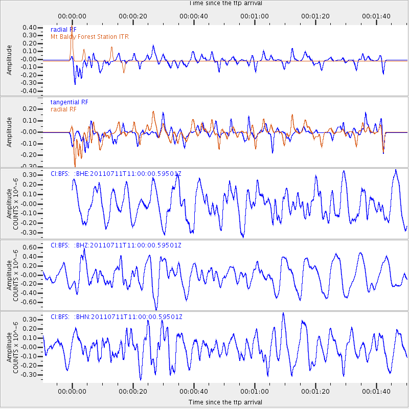
BFS Mt Baldy Forest Station - Earthquake Result Viewer
*The percent match for this event was below the threshold and hence no stack was calculated.
| Earthquake location: |
Tonga Islands Region |
| Earthquake latitude/longitude: |
-22.7/-174.7 |
| Earthquake time(UTC): |
2011/07/11 (192) 10:48:32 GMT |
| Earthquake Depth: |
21 km |
| Earthquake Magnitude: |
5.6 MB, 5.4 MS, 5.6 MW, 5.6 MW |
| Earthquake Catalog/Contributor: |
WHDF/NEIC |
|
| Network: |
CI Caltech Regional Seismic Network |
| Station: |
BFS Mt Baldy Forest Station |
| Lat/Lon: |
34.24 N/117.66 W |
| Elevation: |
1312 m |
|
| Distance: |
78.4 deg |
| Az: |
45.233 deg |
| Baz: |
232.327 deg |
| Ray Param: |
$rayparam |
*The percent match for this event was below the threshold and hence was not used in the summary stack. |
|
| Radial Match: |
68.44865 % |
| Radial Bump: |
400 |
| Transverse Match: |
57.53244 % |
| Transverse Bump: |
400 |
| SOD ConfigId: |
395004 |
| Insert Time: |
2011-12-16 07:56:38.157 +0000 |
| GWidth: |
2.5 |
| Max Bumps: |
400 |
| Tol: |
0.001 |
|
Signal To Noise
| Channel | StoN | STA | LTA |
| CI:BFS: :BHZ:20110711T11:00:00.59501Z | 1.9564474 | 3.2648185E-7 | 1.6687484E-7 |
| CI:BFS: :BHN:20110711T11:00:00.59501Z | 0.8787174 | 1.1699518E-7 | 1.3314312E-7 |
| CI:BFS: :BHE:20110711T11:00:00.59501Z | 1.4521772 | 2.0319008E-7 | 1.39921E-7 |
| Arrivals |
| Ps | |
| PpPs | |
| PsPs/PpSs | |


