You are here: Home > Network List > G - GEOSCOPE Stations List
> Station INU Inuyama, Japan > Earthquake Result Viewer
INU Inuyama, Japan - Earthquake Result Viewer
*The percent match for this event was below the threshold and hence no stack was calculated.
| Earthquake location: |
Tonga Islands Region |
| Earthquake latitude/longitude: |
-22.7/-174.7 |
| Earthquake time(UTC): |
2011/07/11 (192) 10:48:32 GMT |
| Earthquake Depth: |
21 km |
| Earthquake Magnitude: |
5.6 MB, 5.4 MS, 5.6 MW, 5.6 MW |
| Earthquake Catalog/Contributor: |
WHDF/NEIC |
|
| Network: |
G GEOSCOPE |
| Station: |
INU Inuyama, Japan |
| Lat/Lon: |
35.35 N/137.03 E |
| Elevation: |
132 m |
|
| Distance: |
73.6 deg |
| Az: |
320.546 deg |
| Baz: |
134.114 deg |
| Ray Param: |
$rayparam |
*The percent match for this event was below the threshold and hence was not used in the summary stack. |
|
| Radial Match: |
75.917786 % |
| Radial Bump: |
400 |
| Transverse Match: |
52.351532 % |
| Transverse Bump: |
400 |
| SOD ConfigId: |
395004 |
| Insert Time: |
2011-12-16 07:58:56.349 +0000 |
| GWidth: |
2.5 |
| Max Bumps: |
400 |
| Tol: |
0.001 |
|
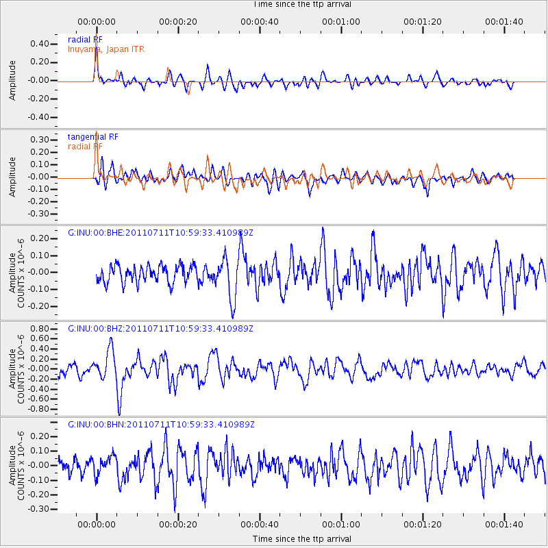
Signal To Noise
| Channel | StoN | STA | LTA |
| G:INU:00:BHZ:20110711T10:59:33.410989Z | 3.5806737 | 2.921795E-7 | 8.1599026E-8 |
| G:INU:00:BHN:20110711T10:59:33.410989Z | 0.9484806 | 6.372872E-8 | 6.719033E-8 |
| G:INU:00:BHE:20110711T10:59:33.410989Z | 2.5284932 | 1.2496145E-7 | 4.942131E-8 |
| Arrivals |
| Ps | |
| PpPs | |
| PsPs/PpSs | |


