You are here: Home > Network List > G - GEOSCOPE Stations List
> Station CAN Canberra, Australia > Earthquake Result Viewer
CAN Canberra, Australia - Earthquake Result Viewer

| Earthquake location: |
Northern Molucca Sea |
| Earthquake latitude/longitude: |
0.4/125.9 |
| Earthquake time(UTC): |
1993/12/09 (343) 11:38:30 GMT |
| Earthquake Depth: |
33 km |
| Earthquake Magnitude: |
6.1 MB, 6.4 MS, 6.3 UNKNOWN, 6.6 MW |
| Earthquake Catalog/Contributor: |
WHDF/NEIC |
|
| Network: |
G GEOSCOPE |
| Station: |
CAN Canberra, Australia |
| Lat/Lon: |
35.32 S/149.00 E |
| Elevation: |
650 m |
|
| Distance: |
41.6 deg |
| Az: |
151.088 deg |
| Baz: |
323.758 deg |
| Ray Param: |
0.07362577 |
| Estimated Moho Depth: |
24.25 km |
| Estimated Crust Vp/Vs: |
1.67 |
| Assumed Crust Vp: |
6.633 km/s |
| Estimated Crust Vs: |
3.966 km/s |
| Estimated Crust Poisson's Ratio: |
0.22 |
|
| Radial Match: |
95.42887 % |
| Radial Bump: |
363 |
| Transverse Match: |
72.24116 % |
| Transverse Bump: |
400 |
| SOD ConfigId: |
16938 |
| Insert Time: |
2010-02-26 21:39:20.315 +0000 |
| GWidth: |
2.5 |
| Max Bumps: |
400 |
| Tol: |
0.001 |
|
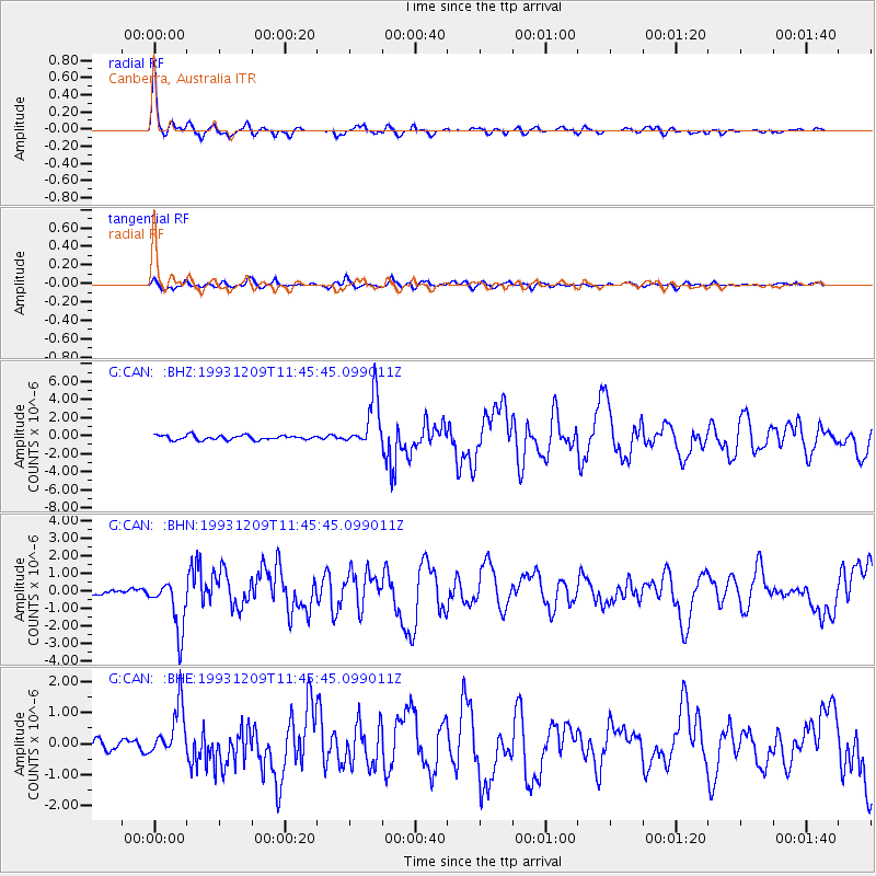
Signal To Noise
| Channel | StoN | STA | LTA |
| G:CAN: :BHN:19931209T11:45:45.099011Z | 6.755595 | 1.5025498E-6 | 2.2241561E-7 |
| G:CAN: :BHE:19931209T11:45:45.099011Z | 4.9262023 | 8.2830934E-7 | 1.6814359E-7 |
| G:CAN: :BHZ:19931209T11:45:45.099011Z | 11.130088 | 2.825075E-6 | 2.5382323E-7 |
| Arrivals |
| Ps | 2.7 SECOND |
| PpPs | 9.0 SECOND |
| PsPs/PpSs | 12 SECOND |


