You are here: Home > Network List > IW - Intermountain West Stations List
> Station IMW Indian Meadow, Wyoming, USA > Earthquake Result Viewer
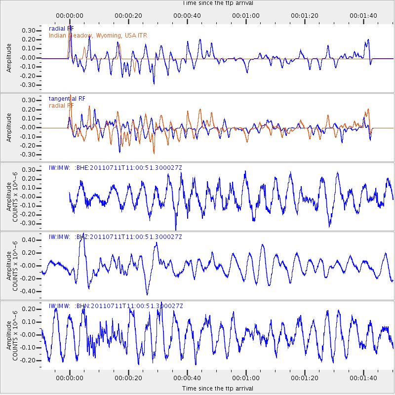
IMW Indian Meadow, Wyoming, USA - Earthquake Result Viewer
*The percent match for this event was below the threshold and hence no stack was calculated.
| Earthquake location: |
Tonga Islands Region |
| Earthquake latitude/longitude: |
-22.7/-174.7 |
| Earthquake time(UTC): |
2011/07/11 (192) 10:48:32 GMT |
| Earthquake Depth: |
21 km |
| Earthquake Magnitude: |
5.6 MB, 5.4 MS, 5.6 MW, 5.6 MW |
| Earthquake Catalog/Contributor: |
WHDF/NEIC |
|
| Network: |
IW Intermountain West |
| Station: |
IMW Indian Meadow, Wyoming, USA |
| Lat/Lon: |
43.90 N/110.94 W |
| Elevation: |
2646 m |
|
| Distance: |
88.3 deg |
| Az: |
40.463 deg |
| Baz: |
236.008 deg |
| Ray Param: |
$rayparam |
*The percent match for this event was below the threshold and hence was not used in the summary stack. |
|
| Radial Match: |
64.827835 % |
| Radial Bump: |
400 |
| Transverse Match: |
58.595173 % |
| Transverse Bump: |
400 |
| SOD ConfigId: |
395004 |
| Insert Time: |
2011-12-16 08:02:31.217 +0000 |
| GWidth: |
2.5 |
| Max Bumps: |
400 |
| Tol: |
0.001 |
|
Signal To Noise
| Channel | StoN | STA | LTA |
| IW:IMW: :BHZ:20110711T11:00:51.300027Z | 3.1486213 | 2.5459008E-7 | 8.085764E-8 |
| IW:IMW: :BHN:20110711T11:00:51.300027Z | 1.5276437 | 1.298362E-7 | 8.499114E-8 |
| IW:IMW: :BHE:20110711T11:00:51.300027Z | 1.4447415 | 1.1983737E-7 | 8.2947274E-8 |
| Arrivals |
| Ps | |
| PpPs | |
| PsPs/PpSs | |


