You are here: Home > Network List > TA - USArray Transportable Network (new EarthScope stations) Stations List
> Station 234A Clairette, TX, USA > Earthquake Result Viewer
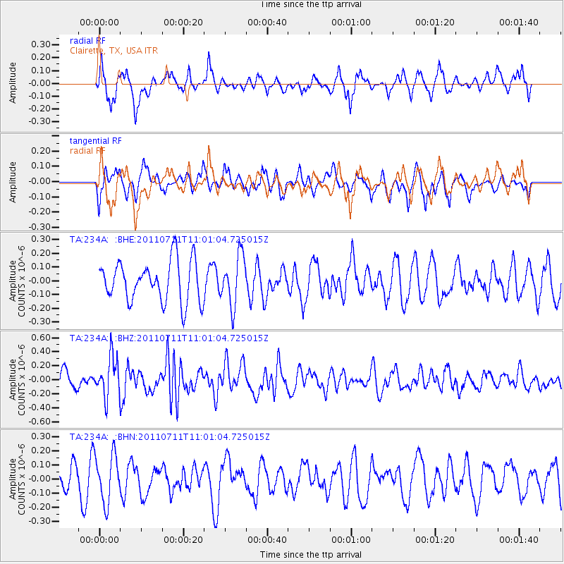
234A Clairette, TX, USA - Earthquake Result Viewer
*The percent match for this event was below the threshold and hence no stack was calculated.
| Earthquake location: |
Tonga Islands Region |
| Earthquake latitude/longitude: |
-22.7/-174.7 |
| Earthquake time(UTC): |
2011/07/11 (192) 10:48:32 GMT |
| Earthquake Depth: |
21 km |
| Earthquake Magnitude: |
5.6 MB, 5.4 MS, 5.6 MW, 5.6 MW |
| Earthquake Catalog/Contributor: |
WHDF/NEIC |
|
| Network: |
TA USArray Transportable Network (new EarthScope stations) |
| Station: |
234A Clairette, TX, USA |
| Lat/Lon: |
32.00 N/98.14 W |
| Elevation: |
358 m |
|
| Distance: |
91.2 deg |
| Az: |
55.759 deg |
| Baz: |
243.984 deg |
| Ray Param: |
$rayparam |
*The percent match for this event was below the threshold and hence was not used in the summary stack. |
|
| Radial Match: |
62.57787 % |
| Radial Bump: |
386 |
| Transverse Match: |
43.73104 % |
| Transverse Bump: |
369 |
| SOD ConfigId: |
395004 |
| Insert Time: |
2011-12-16 08:42:08.941 +0000 |
| GWidth: |
2.5 |
| Max Bumps: |
400 |
| Tol: |
0.001 |
|
Signal To Noise
| Channel | StoN | STA | LTA |
| TA:234A: :BHZ:20110711T11:01:04.725015Z | 2.440426 | 2.9085948E-7 | 1.1918389E-7 |
| TA:234A: :BHN:20110711T11:01:04.725015Z | 1.5003684 | 1.6683882E-7 | 1.1119857E-7 |
| TA:234A: :BHE:20110711T11:01:04.725015Z | 1.2482967 | 1.8491978E-7 | 1.4813769E-7 |
| Arrivals |
| Ps | |
| PpPs | |
| PsPs/PpSs | |


