You are here: Home > Network List > TA - USArray Transportable Network (new EarthScope stations) Stations List
> Station O03D Paynes Creek, CA, USA > Earthquake Result Viewer
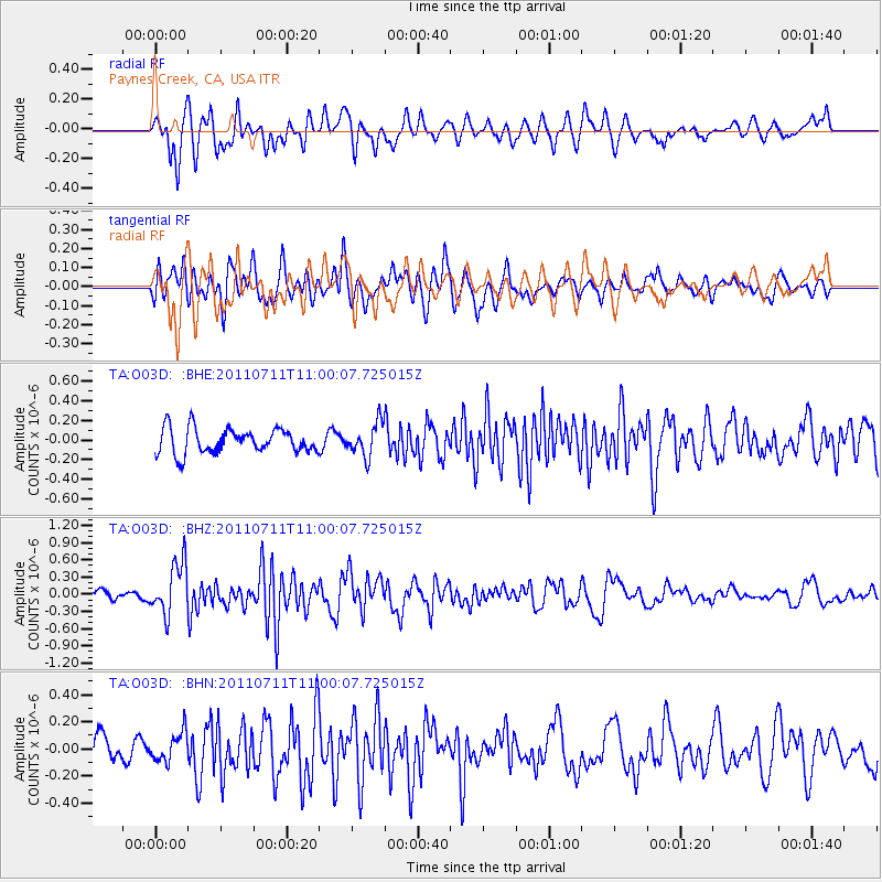
O03D Paynes Creek, CA, USA - Earthquake Result Viewer
*The percent match for this event was below the threshold and hence no stack was calculated.
| Earthquake location: |
Tonga Islands Region |
| Earthquake latitude/longitude: |
-22.7/-174.7 |
| Earthquake time(UTC): |
2011/07/11 (192) 10:48:32 GMT |
| Earthquake Depth: |
21 km |
| Earthquake Magnitude: |
5.6 MB, 5.4 MS, 5.6 MW, 5.6 MW |
| Earthquake Catalog/Contributor: |
WHDF/NEIC |
|
| Network: |
TA USArray Transportable Network (new EarthScope stations) |
| Station: |
O03D Paynes Creek, CA, USA |
| Lat/Lon: |
40.29 N/121.80 W |
| Elevation: |
968 m |
|
| Distance: |
79.7 deg |
| Az: |
38.344 deg |
| Baz: |
228.515 deg |
| Ray Param: |
$rayparam |
*The percent match for this event was below the threshold and hence was not used in the summary stack. |
|
| Radial Match: |
63.41912 % |
| Radial Bump: |
400 |
| Transverse Match: |
68.66309 % |
| Transverse Bump: |
400 |
| SOD ConfigId: |
395004 |
| Insert Time: |
2011-12-16 08:47:01.065 +0000 |
| GWidth: |
2.5 |
| Max Bumps: |
400 |
| Tol: |
0.001 |
|
Signal To Noise
| Channel | StoN | STA | LTA |
| TA:O03D: :BHZ:20110711T11:00:07.725015Z | 4.9443455 | 4.5244954E-7 | 9.1508475E-8 |
| TA:O03D: :BHN:20110711T11:00:07.725015Z | 1.2340969 | 1.0708963E-7 | 8.6775714E-8 |
| TA:O03D: :BHE:20110711T11:00:07.725015Z | 1.3397678 | 1.68368E-7 | 1.2566953E-7 |
| Arrivals |
| Ps | |
| PpPs | |
| PsPs/PpSs | |


