You are here: Home > Network List > TA - USArray Transportable Network (new EarthScope stations) Stations List
> Station H25A Fruitdale, SD, USA > Earthquake Result Viewer
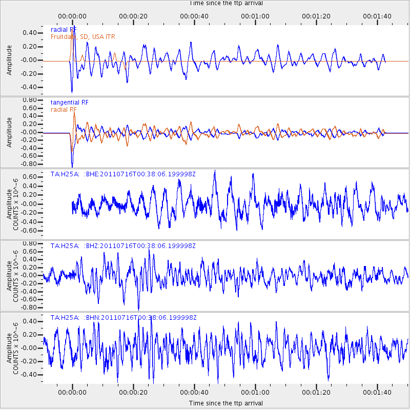
H25A Fruitdale, SD, USA - Earthquake Result Viewer
*The percent match for this event was below the threshold and hence no stack was calculated.
| Earthquake location: |
Near Coast Of Central Chile |
| Earthquake latitude/longitude: |
-33.8/-71.8 |
| Earthquake time(UTC): |
2011/07/16 (197) 00:26:12 GMT |
| Earthquake Depth: |
20 km |
| Earthquake Magnitude: |
5.8 MB, 5.8 MS, 6.1 MW, 6.0 MW |
| Earthquake Catalog/Contributor: |
WHDF/NEIC |
|
| Network: |
TA USArray Transportable Network (new EarthScope stations) |
| Station: |
H25A Fruitdale, SD, USA |
| Lat/Lon: |
44.62 N/103.60 W |
| Elevation: |
942 m |
|
| Distance: |
83.2 deg |
| Az: |
337.754 deg |
| Baz: |
153.81 deg |
| Ray Param: |
$rayparam |
*The percent match for this event was below the threshold and hence was not used in the summary stack. |
|
| Radial Match: |
61.738556 % |
| Radial Bump: |
400 |
| Transverse Match: |
82.15641 % |
| Transverse Bump: |
396 |
| SOD ConfigId: |
401841 |
| Insert Time: |
2011-12-21 00:37:56.020 +0000 |
| GWidth: |
2.5 |
| Max Bumps: |
400 |
| Tol: |
0.001 |
|
Signal To Noise
| Channel | StoN | STA | LTA |
| TA:H25A: :BHZ:20110716T00:38:06.199998Z | 2.4593112 | 2.1462098E-7 | 8.726874E-8 |
| TA:H25A: :BHN:20110716T00:38:06.199998Z | 1.8100301 | 1.6892625E-7 | 9.332787E-8 |
| TA:H25A: :BHE:20110716T00:38:06.199998Z | 2.000336 | 2.6962846E-7 | 1.3479159E-7 |
| Arrivals |
| Ps | |
| PpPs | |
| PsPs/PpSs | |


