You are here: Home > Network List > TA - USArray Transportable Network (new EarthScope stations) Stations List
> Station E31A Nome, ND, USA > Earthquake Result Viewer
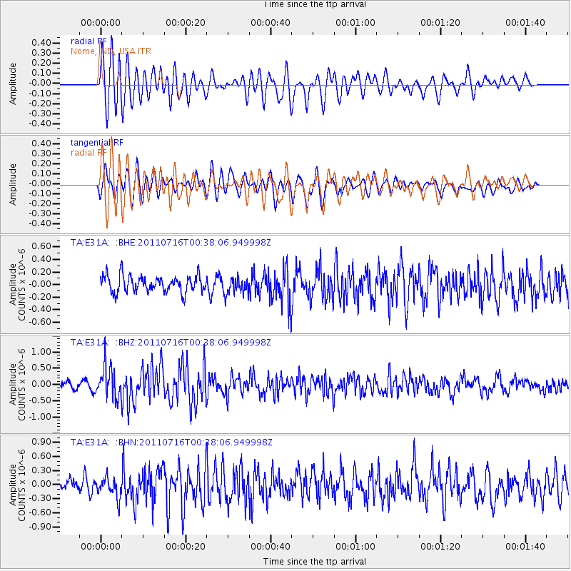
E31A Nome, ND, USA - Earthquake Result Viewer
*The percent match for this event was below the threshold and hence no stack was calculated.
| Earthquake location: |
Near Coast Of Central Chile |
| Earthquake latitude/longitude: |
-33.8/-71.8 |
| Earthquake time(UTC): |
2011/07/16 (197) 00:26:12 GMT |
| Earthquake Depth: |
20 km |
| Earthquake Magnitude: |
5.8 MB, 5.8 MS, 6.1 MW, 6.0 MW |
| Earthquake Catalog/Contributor: |
WHDF/NEIC |
|
| Network: |
TA USArray Transportable Network (new EarthScope stations) |
| Station: |
E31A Nome, ND, USA |
| Lat/Lon: |
46.56 N/97.89 W |
| Elevation: |
427 m |
|
| Distance: |
83.4 deg |
| Az: |
342.234 deg |
| Baz: |
158.4 deg |
| Ray Param: |
$rayparam |
*The percent match for this event was below the threshold and hence was not used in the summary stack. |
|
| Radial Match: |
70.807014 % |
| Radial Bump: |
400 |
| Transverse Match: |
60.63497 % |
| Transverse Bump: |
400 |
| SOD ConfigId: |
401841 |
| Insert Time: |
2011-12-21 00:54:04.679 +0000 |
| GWidth: |
2.5 |
| Max Bumps: |
400 |
| Tol: |
0.001 |
|
Signal To Noise
| Channel | StoN | STA | LTA |
| TA:E31A: :BHZ:20110716T00:38:06.949998Z | 4.0557694 | 4.851154E-7 | 1.1961119E-7 |
| TA:E31A: :BHN:20110716T00:38:06.949998Z | 1.3981172 | 2.2013508E-7 | 1.574511E-7 |
| TA:E31A: :BHE:20110716T00:38:06.949998Z | 1.0207416 | 1.314E-7 | 1.2872994E-7 |
| Arrivals |
| Ps | |
| PpPs | |
| PsPs/PpSs | |


