You are here: Home > Network List > TA - USArray Transportable Network (new EarthScope stations) Stations List
> Station D37A Cotton, MN, USA > Earthquake Result Viewer
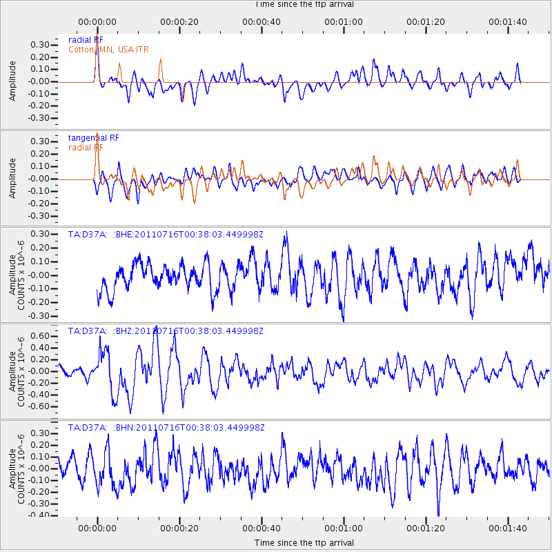
D37A Cotton, MN, USA - Earthquake Result Viewer
*The percent match for this event was below the threshold and hence no stack was calculated.
| Earthquake location: |
Near Coast Of Central Chile |
| Earthquake latitude/longitude: |
-33.8/-71.8 |
| Earthquake time(UTC): |
2011/07/16 (197) 00:26:12 GMT |
| Earthquake Depth: |
20 km |
| Earthquake Magnitude: |
5.8 MB, 5.8 MS, 6.1 MW, 6.0 MW |
| Earthquake Catalog/Contributor: |
WHDF/NEIC |
|
| Network: |
TA USArray Transportable Network (new EarthScope stations) |
| Station: |
D37A Cotton, MN, USA |
| Lat/Lon: |
47.16 N/92.43 W |
| Elevation: |
413 m |
|
| Distance: |
82.7 deg |
| Az: |
345.995 deg |
| Baz: |
162.829 deg |
| Ray Param: |
$rayparam |
*The percent match for this event was below the threshold and hence was not used in the summary stack. |
|
| Radial Match: |
57.215405 % |
| Radial Bump: |
400 |
| Transverse Match: |
65.98954 % |
| Transverse Bump: |
400 |
| SOD ConfigId: |
401841 |
| Insert Time: |
2011-12-21 00:55:34.393 +0000 |
| GWidth: |
2.5 |
| Max Bumps: |
400 |
| Tol: |
0.001 |
|
Signal To Noise
| Channel | StoN | STA | LTA |
| TA:D37A: :BHZ:20110716T00:38:03.449998Z | 4.3366184 | 3.6774182E-7 | 8.479921E-8 |
| TA:D37A: :BHN:20110716T00:38:03.449998Z | 0.9679639 | 1.476992E-7 | 1.5258752E-7 |
| TA:D37A: :BHE:20110716T00:38:03.449998Z | 1.0501814 | 8.9096055E-8 | 8.483873E-8 |
| Arrivals |
| Ps | |
| PpPs | |
| PsPs/PpSs | |


