You are here: Home > Network List > TA - USArray Transportable Network (new EarthScope stations) Stations List
> Station H37A Dierke Farm, Cannon Falls, MN, USA > Earthquake Result Viewer
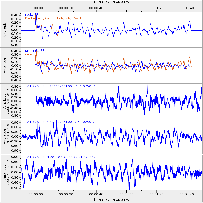
H37A Dierke Farm, Cannon Falls, MN, USA - Earthquake Result Viewer
*The percent match for this event was below the threshold and hence no stack was calculated.
| Earthquake location: |
Near Coast Of Central Chile |
| Earthquake latitude/longitude: |
-33.8/-71.8 |
| Earthquake time(UTC): |
2011/07/16 (197) 00:26:12 GMT |
| Earthquake Depth: |
20 km |
| Earthquake Magnitude: |
5.8 MB, 5.8 MS, 6.1 MW, 6.0 MW |
| Earthquake Catalog/Contributor: |
WHDF/NEIC |
|
| Network: |
TA USArray Transportable Network (new EarthScope stations) |
| Station: |
H37A Dierke Farm, Cannon Falls, MN, USA |
| Lat/Lon: |
44.58 N/92.92 W |
| Elevation: |
321 m |
|
| Distance: |
80.4 deg |
| Az: |
344.884 deg |
| Baz: |
162.313 deg |
| Ray Param: |
$rayparam |
*The percent match for this event was below the threshold and hence was not used in the summary stack. |
|
| Radial Match: |
60.35476 % |
| Radial Bump: |
400 |
| Transverse Match: |
58.239704 % |
| Transverse Bump: |
400 |
| SOD ConfigId: |
401841 |
| Insert Time: |
2011-12-21 00:57:28.455 +0000 |
| GWidth: |
2.5 |
| Max Bumps: |
400 |
| Tol: |
0.001 |
|
Signal To Noise
| Channel | StoN | STA | LTA |
| TA:H37A: :BHZ:20110716T00:37:51.02501Z | 3.5500283 | 4.803331E-7 | 1.35304E-7 |
| TA:H37A: :BHN:20110716T00:37:51.02501Z | 0.50676495 | 1.6146798E-7 | 3.18625E-7 |
| TA:H37A: :BHE:20110716T00:37:51.02501Z | 0.60229355 | 1.0410661E-7 | 1.7285028E-7 |
| Arrivals |
| Ps | |
| PpPs | |
| PsPs/PpSs | |


