You are here: Home > Network List > TA - USArray Transportable Network (new EarthScope stations) Stations List
> Station P38A Dawn, MO, USA > Earthquake Result Viewer
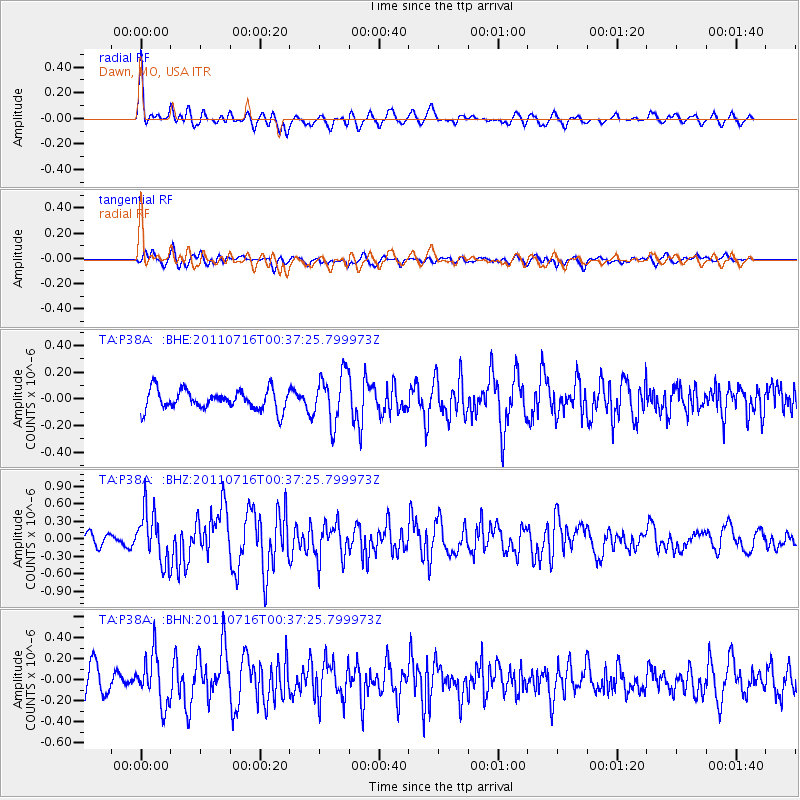
P38A Dawn, MO, USA - Earthquake Result Viewer
*The percent match for this event was below the threshold and hence no stack was calculated.
| Earthquake location: |
Near Coast Of Central Chile |
| Earthquake latitude/longitude: |
-33.8/-71.8 |
| Earthquake time(UTC): |
2011/07/16 (197) 00:26:12 GMT |
| Earthquake Depth: |
20 km |
| Earthquake Magnitude: |
5.8 MB, 5.8 MS, 6.1 MW, 6.0 MW |
| Earthquake Catalog/Contributor: |
WHDF/NEIC |
|
| Network: |
TA USArray Transportable Network (new EarthScope stations) |
| Station: |
P38A Dawn, MO, USA |
| Lat/Lon: |
39.62 N/93.53 W |
| Elevation: |
248 m |
|
| Distance: |
75.8 deg |
| Az: |
342.867 deg |
| Baz: |
161.486 deg |
| Ray Param: |
$rayparam |
*The percent match for this event was below the threshold and hence was not used in the summary stack. |
|
| Radial Match: |
58.526756 % |
| Radial Bump: |
374 |
| Transverse Match: |
51.720406 % |
| Transverse Bump: |
400 |
| SOD ConfigId: |
401841 |
| Insert Time: |
2011-12-21 01:00:38.814 +0000 |
| GWidth: |
2.5 |
| Max Bumps: |
400 |
| Tol: |
0.001 |
|
Signal To Noise
| Channel | StoN | STA | LTA |
| TA:P38A: :BHZ:20110716T00:37:25.799973Z | 4.2187824 | 4.34071E-7 | 1.0289012E-7 |
| TA:P38A: :BHN:20110716T00:37:25.799973Z | 2.0474854 | 2.3718378E-7 | 1.15841516E-7 |
| TA:P38A: :BHE:20110716T00:37:25.799973Z | 2.497116 | 1.8633246E-7 | 7.461906E-8 |
| Arrivals |
| Ps | |
| PpPs | |
| PsPs/PpSs | |


