You are here: Home > Network List > TA - USArray Transportable Network (new EarthScope stations) Stations List
> Station Q43A New Douglas, IL, USA > Earthquake Result Viewer
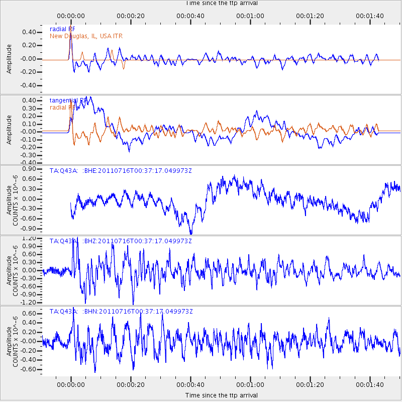
Q43A New Douglas, IL, USA - Earthquake Result Viewer
*The percent match for this event was below the threshold and hence no stack was calculated.
| Earthquake location: |
Near Coast Of Central Chile |
| Earthquake latitude/longitude: |
-33.8/-71.8 |
| Earthquake time(UTC): |
2011/07/16 (197) 00:26:12 GMT |
| Earthquake Depth: |
20 km |
| Earthquake Magnitude: |
5.8 MB, 5.8 MS, 6.1 MW, 6.0 MW |
| Earthquake Catalog/Contributor: |
WHDF/NEIC |
|
| Network: |
TA USArray Transportable Network (new EarthScope stations) |
| Station: |
Q43A New Douglas, IL, USA |
| Lat/Lon: |
38.94 N/89.70 W |
| Elevation: |
202 m |
|
| Distance: |
74.3 deg |
| Az: |
345.607 deg |
| Baz: |
164.611 deg |
| Ray Param: |
$rayparam |
*The percent match for this event was below the threshold and hence was not used in the summary stack. |
|
| Radial Match: |
71.603386 % |
| Radial Bump: |
400 |
| Transverse Match: |
25.787594 % |
| Transverse Bump: |
400 |
| SOD ConfigId: |
401841 |
| Insert Time: |
2011-12-21 01:08:35.359 +0000 |
| GWidth: |
2.5 |
| Max Bumps: |
400 |
| Tol: |
0.001 |
|
Signal To Noise
| Channel | StoN | STA | LTA |
| TA:Q43A: :BHZ:20110716T00:37:17.049973Z | 5.928266 | 6.002515E-7 | 1.0125245E-7 |
| TA:Q43A: :BHN:20110716T00:37:17.049973Z | 2.7067723 | 2.6450743E-7 | 9.772061E-8 |
| TA:Q43A: :BHE:20110716T00:37:17.049973Z | 1.2926471 | 2.1219732E-7 | 1.641572E-7 |
| Arrivals |
| Ps | |
| PpPs | |
| PsPs/PpSs | |


