
CAN Canberra, Australia - Earthquake Result Viewer
| ||||||||||||||||||
| ||||||||||||||||||
| ||||||||||||||||||
|
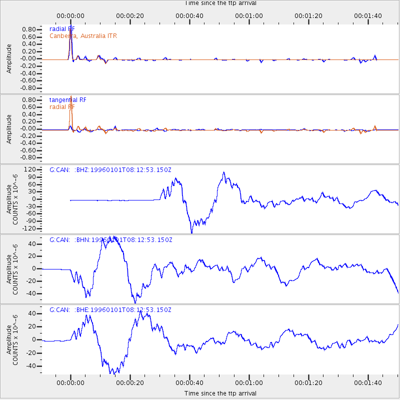
Signal To Noise
| Channel | StoN | STA | LTA |
| G:CAN: :BHN:19960101T08:12:53.150Z | 58.204468 | 1.6679707E-5 | 2.8657092E-7 |
| G:CAN: :BHE:19960101T08:12:53.150Z | 39.870167 | 1.4063387E-5 | 3.527296E-7 |
| G:CAN: :BHZ:19960101T08:12:53.150Z | 129.98369 | 3.732301E-5 | 2.871361E-7 |
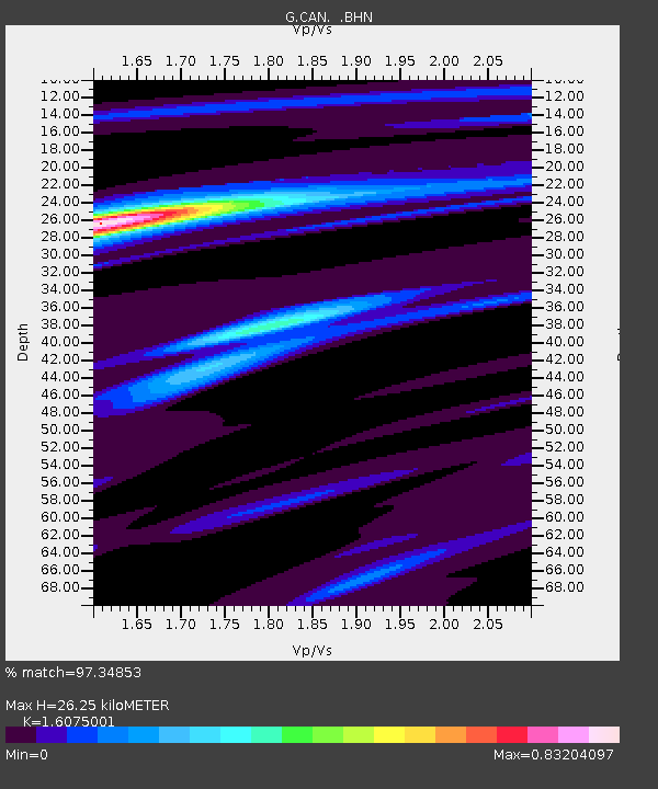
| Arrivals | |
| Ps | 2.6 SECOND |
| PpPs | 9.6 SECOND |
| PsPs/PpSs | 12 SECOND |

