You are here: Home > Network List > TA - USArray Transportable Network (new EarthScope stations) Stations List
> Station 336A Riesel, TX, USA > Earthquake Result Viewer
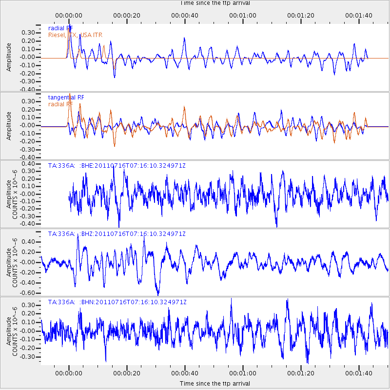
336A Riesel, TX, USA - Earthquake Result Viewer
*The percent match for this event was below the threshold and hence no stack was calculated.
| Earthquake location: |
Tonga Islands Region |
| Earthquake latitude/longitude: |
-22.4/-175.0 |
| Earthquake time(UTC): |
2011/07/16 (197) 07:03:32 GMT |
| Earthquake Depth: |
7.0 km |
| Earthquake Magnitude: |
5.7 MB, 5.6 MS, 5.8 MW, 5.7 MW |
| Earthquake Catalog/Contributor: |
WHDF/NEIC |
|
| Network: |
TA USArray Transportable Network (new EarthScope stations) |
| Station: |
336A Riesel, TX, USA |
| Lat/Lon: |
31.39 N/96.84 W |
| Elevation: |
140 m |
|
| Distance: |
92.0 deg |
| Az: |
56.877 deg |
| Baz: |
244.965 deg |
| Ray Param: |
$rayparam |
*The percent match for this event was below the threshold and hence was not used in the summary stack. |
|
| Radial Match: |
59.107777 % |
| Radial Bump: |
390 |
| Transverse Match: |
66.07448 % |
| Transverse Bump: |
328 |
| SOD ConfigId: |
401841 |
| Insert Time: |
2011-12-21 01:34:55.343 +0000 |
| GWidth: |
2.5 |
| Max Bumps: |
400 |
| Tol: |
0.001 |
|
Signal To Noise
| Channel | StoN | STA | LTA |
| TA:336A: :BHZ:20110716T07:16:10.324971Z | 3.4284658 | 2.2553395E-7 | 6.5782764E-8 |
| TA:336A: :BHN:20110716T07:16:10.324971Z | 1.2468694 | 1.05817996E-7 | 8.486694E-8 |
| TA:336A: :BHE:20110716T07:16:10.324971Z | 0.77715594 | 1.1055096E-7 | 1.4225067E-7 |
| Arrivals |
| Ps | |
| PpPs | |
| PsPs/PpSs | |


