You are here: Home > Network List > TA - USArray Transportable Network (new EarthScope stations) Stations List
> Station E31A Nome, ND, USA > Earthquake Result Viewer
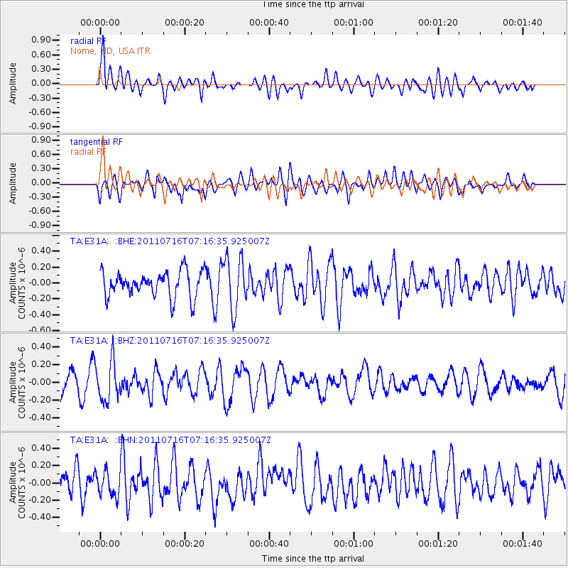
E31A Nome, ND, USA - Earthquake Result Viewer
*The percent match for this event was below the threshold and hence no stack was calculated.
| Earthquake location: |
Tonga Islands Region |
| Earthquake latitude/longitude: |
-22.4/-175.0 |
| Earthquake time(UTC): |
2011/07/16 (197) 07:03:32 GMT |
| Earthquake Depth: |
7.0 km |
| Earthquake Magnitude: |
5.7 MB, 5.6 MS, 5.8 MW, 5.7 MW |
| Earthquake Catalog/Contributor: |
WHDF/NEIC |
|
| Network: |
TA USArray Transportable Network (new EarthScope stations) |
| Station: |
E31A Nome, ND, USA |
| Lat/Lon: |
46.56 N/97.89 W |
| Elevation: |
427 m |
|
| Distance: |
97.6 deg |
| Az: |
42.736 deg |
| Baz: |
245.491 deg |
| Ray Param: |
$rayparam |
*The percent match for this event was below the threshold and hence was not used in the summary stack. |
|
| Radial Match: |
71.143326 % |
| Radial Bump: |
400 |
| Transverse Match: |
48.083 % |
| Transverse Bump: |
400 |
| SOD ConfigId: |
401841 |
| Insert Time: |
2011-12-21 01:39:20.640 +0000 |
| GWidth: |
2.5 |
| Max Bumps: |
400 |
| Tol: |
0.001 |
|
Signal To Noise
| Channel | StoN | STA | LTA |
| TA:E31A: :BHZ:20110716T07:16:35.925007Z | 2.3120027 | 2.2208465E-7 | 9.6057256E-8 |
| TA:E31A: :BHN:20110716T07:16:35.925007Z | 0.959648 | 1.4614946E-7 | 1.5229486E-7 |
| TA:E31A: :BHE:20110716T07:16:35.925007Z | 2.0068185 | 3.2441227E-7 | 1.6165502E-7 |
| Arrivals |
| Ps | |
| PpPs | |
| PsPs/PpSs | |


