You are here: Home > Network List > UW - Pacific Northwest Regional Seismic Network Stations List
> Station YACT Amboy, WA, USA > Earthquake Result Viewer
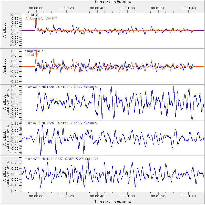
YACT Amboy, WA, USA - Earthquake Result Viewer
*The percent match for this event was below the threshold and hence no stack was calculated.
| Earthquake location: |
Tonga Islands Region |
| Earthquake latitude/longitude: |
-22.4/-175.0 |
| Earthquake time(UTC): |
2011/07/16 (197) 07:03:32 GMT |
| Earthquake Depth: |
7.0 km |
| Earthquake Magnitude: |
5.7 MB, 5.6 MS, 5.8 MW, 5.7 MW |
| Earthquake Catalog/Contributor: |
WHDF/NEIC |
|
| Network: |
UW Pacific Northwest Regional Seismic Network |
| Station: |
YACT Amboy, WA, USA |
| Lat/Lon: |
45.93 N/122.42 W |
| Elevation: |
211 m |
|
| Distance: |
83.1 deg |
| Az: |
33.943 deg |
| Baz: |
227.75 deg |
| Ray Param: |
$rayparam |
*The percent match for this event was below the threshold and hence was not used in the summary stack. |
|
| Radial Match: |
72.13663 % |
| Radial Bump: |
400 |
| Transverse Match: |
67.463356 % |
| Transverse Bump: |
400 |
| SOD ConfigId: |
401841 |
| Insert Time: |
2011-12-21 01:43:26.155 +0000 |
| GWidth: |
2.5 |
| Max Bumps: |
400 |
| Tol: |
0.001 |
|
Signal To Noise
| Channel | StoN | STA | LTA |
| UW:YACT: :BHZ:20110716T07:15:27.425007Z | 6.093501 | 6.5412195E-7 | 1.07347475E-7 |
| UW:YACT: :BHN:20110716T07:15:27.425007Z | 1.9679502 | 2.138596E-7 | 1.0867124E-7 |
| UW:YACT: :BHE:20110716T07:15:27.425007Z | 0.8260219 | 9.6051934E-8 | 1.1628255E-7 |
| Arrivals |
| Ps | |
| PpPs | |
| PsPs/PpSs | |


