You are here: Home > Network List > G - GEOSCOPE Stations List
> Station INU Inuyama, Japan > Earthquake Result Viewer
INU Inuyama, Japan - Earthquake Result Viewer
*The percent match for this event was below the threshold and hence no stack was calculated.
| Earthquake location: |
Banda Sea |
| Earthquake latitude/longitude: |
-7.1/127.6 |
| Earthquake time(UTC): |
2011/07/16 (197) 17:06:39 GMT |
| Earthquake Depth: |
255 km |
| Earthquake Magnitude: |
5.8 MB, 5.9 MW, 5.9 MW |
| Earthquake Catalog/Contributor: |
WHDF/NEIC |
|
| Network: |
G GEOSCOPE |
| Station: |
INU Inuyama, Japan |
| Lat/Lon: |
35.35 N/137.03 E |
| Elevation: |
132 m |
|
| Distance: |
43.2 deg |
| Az: |
11.321 deg |
| Baz: |
193.787 deg |
| Ray Param: |
$rayparam |
*The percent match for this event was below the threshold and hence was not used in the summary stack. |
|
| Radial Match: |
72.049805 % |
| Radial Bump: |
370 |
| Transverse Match: |
63.11573 % |
| Transverse Bump: |
400 |
| SOD ConfigId: |
401841 |
| Insert Time: |
2011-12-21 01:49:55.605 +0000 |
| GWidth: |
2.5 |
| Max Bumps: |
400 |
| Tol: |
0.001 |
|
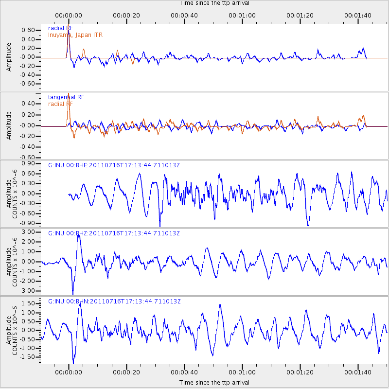
Signal To Noise
| Channel | StoN | STA | LTA |
| G:INU:00:BHZ:20110716T17:13:44.711013Z | 5.257133 | 1.6595143E-6 | 3.1566907E-7 |
| G:INU:00:BHN:20110716T17:13:44.711013Z | 3.9085414 | 9.4742364E-7 | 2.4239824E-7 |
| G:INU:00:BHE:20110716T17:13:44.711013Z | 1.7483184 | 4.4350824E-7 | 2.5367703E-7 |
| Arrivals |
| Ps | |
| PpPs | |
| PsPs/PpSs | |


