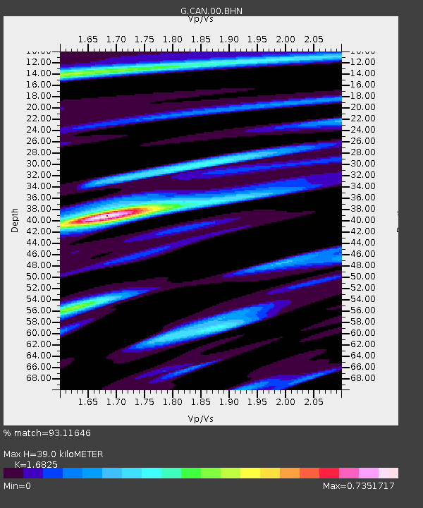
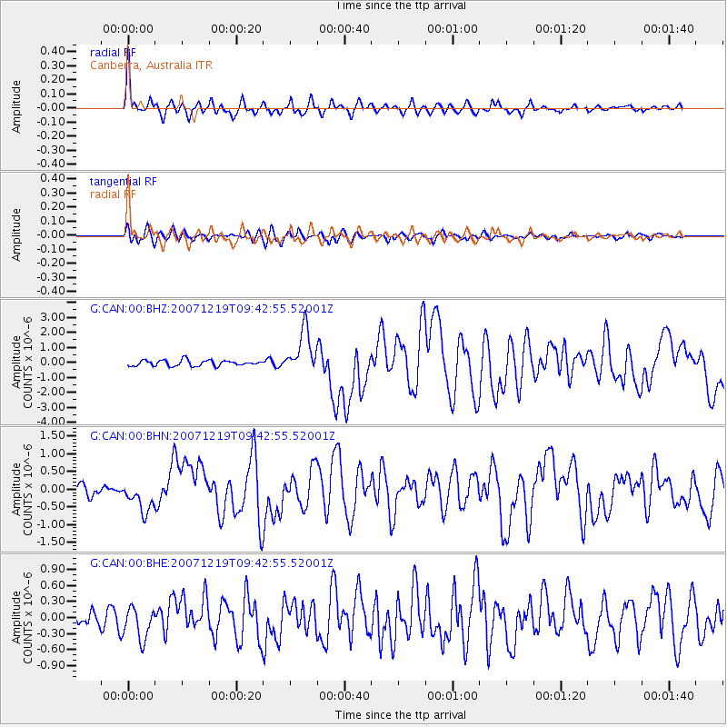
CAN Canberra, Australia - Earthquake Result Viewer

Earthquake location: Andreanof Islands, Aleutian Is.
Earthquake latitude/longitude: 51.4/-179.5
Earthquake time(UTC): 2007/12/19 (353) 09:30:27 GMT
Earthquake Depth: 29 km
Earthquake Magnitude: 6.4 MB, 7.1 MS, 7.1 MW, 7.0 MW
Earthquake Catalog/Contributor: WHDF/NEIC
Network: G GEOSCOPE
Station: CAN Canberra, Australia
Lat/Lon: 35.32 S/149.00 E
Elevation: 650 m
Distance: 90.6 deg
Az: 205.28 deg
Baz: 19.111 deg
Ray Param: 0.041655626
Estimated Moho Depth: 39.0 km
Estimated Crust Vp/Vs: 1.68
Assumed Crust Vp: 6.633 km/s
Estimated Crust Vs: 3.943 km/s
Estimated Crust Poisson's Ratio: 0.23
Radial Match: 93.11646 %
Radial Bump: 400
Transverse Match: 76.9157 %
Transverse Bump: 400
SOD ConfigId: 2564
Insert Time: 2010-02-26 21:41:57.298 +0000
GWidth: 2.5
Max Bumps: 400
Tol: 0.001

Signal To Noise

ChannelStoNSTALTA
G:CAN:00:BHN:20071219T09:42:55.52001Z3.57274914.307504E-71.2056553E-7
G:CAN:00:BHE:20071219T09:42:55.52001Z2.14066342.9939474E-71.3986073E-7
G:CAN:00:BHZ:20071219T09:42:55.52001Z7.8511461.4767993E-61.8809985E-7
Arrivals
Ps4.1 SECOND
PpPs15 SECOND
PsPs/PpSs20 SECOND