You are here: Home > Network List > TA - USArray Transportable Network (new EarthScope stations) Stations List
> Station I03D Drain, OR, USA > Earthquake Result Viewer
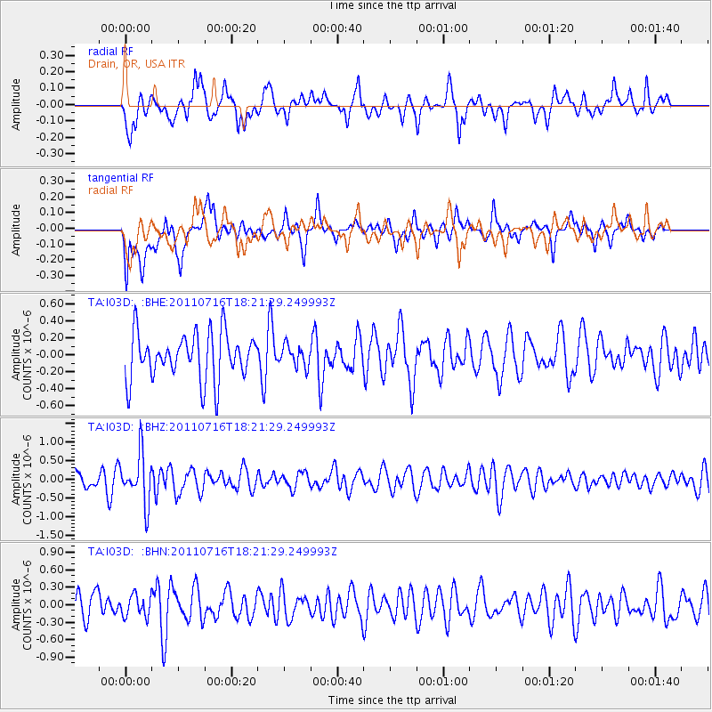
I03D Drain, OR, USA - Earthquake Result Viewer
*The percent match for this event was below the threshold and hence no stack was calculated.
| Earthquake location: |
Vanuatu Islands |
| Earthquake latitude/longitude: |
-18.9/169.4 |
| Earthquake time(UTC): |
2011/07/16 (197) 18:09:40 GMT |
| Earthquake Depth: |
246 km |
| Earthquake Magnitude: |
5.5 MB, 5.7 MW, 5.6 MW |
| Earthquake Catalog/Contributor: |
WHDF/NEIC |
|
| Network: |
TA USArray Transportable Network (new EarthScope stations) |
| Station: |
I03D Drain, OR, USA |
| Lat/Lon: |
43.70 N/123.35 W |
| Elevation: |
140 m |
|
| Distance: |
87.5 deg |
| Az: |
42.045 deg |
| Baz: |
240.967 deg |
| Ray Param: |
$rayparam |
*The percent match for this event was below the threshold and hence was not used in the summary stack. |
|
| Radial Match: |
52.34117 % |
| Radial Bump: |
342 |
| Transverse Match: |
55.33816 % |
| Transverse Bump: |
400 |
| SOD ConfigId: |
401841 |
| Insert Time: |
2011-12-21 02:08:34.125 +0000 |
| GWidth: |
2.5 |
| Max Bumps: |
400 |
| Tol: |
0.001 |
|
Signal To Noise
| Channel | StoN | STA | LTA |
| TA:I03D: :BHZ:20110716T18:21:29.249993Z | 3.3134773 | 6.68513E-7 | 2.0175573E-7 |
| TA:I03D: :BHN:20110716T18:21:29.249993Z | 0.7097958 | 1.8399403E-7 | 2.5922108E-7 |
| TA:I03D: :BHE:20110716T18:21:29.249993Z | 0.4559133 | 1.2413643E-7 | 2.7228077E-7 |
| Arrivals |
| Ps | |
| PpPs | |
| PsPs/PpSs | |


