You are here: Home > Network List > TA - USArray Transportable Network (new EarthScope stations) Stations List
> Station H04D Lebanon, OR, USA > Earthquake Result Viewer
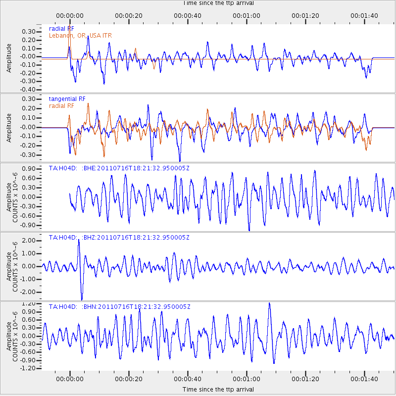
H04D Lebanon, OR, USA - Earthquake Result Viewer
*The percent match for this event was below the threshold and hence no stack was calculated.
| Earthquake location: |
Vanuatu Islands |
| Earthquake latitude/longitude: |
-18.9/169.4 |
| Earthquake time(UTC): |
2011/07/16 (197) 18:09:40 GMT |
| Earthquake Depth: |
246 km |
| Earthquake Magnitude: |
5.5 MB, 5.7 MW, 5.6 MW |
| Earthquake Catalog/Contributor: |
WHDF/NEIC |
|
| Network: |
TA USArray Transportable Network (new EarthScope stations) |
| Station: |
H04D Lebanon, OR, USA |
| Lat/Lon: |
44.52 N/122.74 W |
| Elevation: |
284 m |
|
| Distance: |
88.3 deg |
| Az: |
41.533 deg |
| Baz: |
241.372 deg |
| Ray Param: |
$rayparam |
*The percent match for this event was below the threshold and hence was not used in the summary stack. |
|
| Radial Match: |
51.111458 % |
| Radial Bump: |
400 |
| Transverse Match: |
48.694664 % |
| Transverse Bump: |
400 |
| SOD ConfigId: |
401841 |
| Insert Time: |
2011-12-21 02:09:26.799 +0000 |
| GWidth: |
2.5 |
| Max Bumps: |
400 |
| Tol: |
0.001 |
|
Signal To Noise
| Channel | StoN | STA | LTA |
| TA:H04D: :BHZ:20110716T18:21:32.950005Z | 4.109619 | 1.0322749E-6 | 2.5118504E-7 |
| TA:H04D: :BHN:20110716T18:21:32.950005Z | 1.2760676 | 2.7769212E-7 | 2.1761551E-7 |
| TA:H04D: :BHE:20110716T18:21:32.950005Z | 0.5761248 | 1.9818604E-7 | 3.4399847E-7 |
| Arrivals |
| Ps | |
| PpPs | |
| PsPs/PpSs | |


