You are here: Home > Network List > UW - Pacific Northwest Regional Seismic Network Stations List
> Station MRBL Marblemount, WA, USA > Earthquake Result Viewer
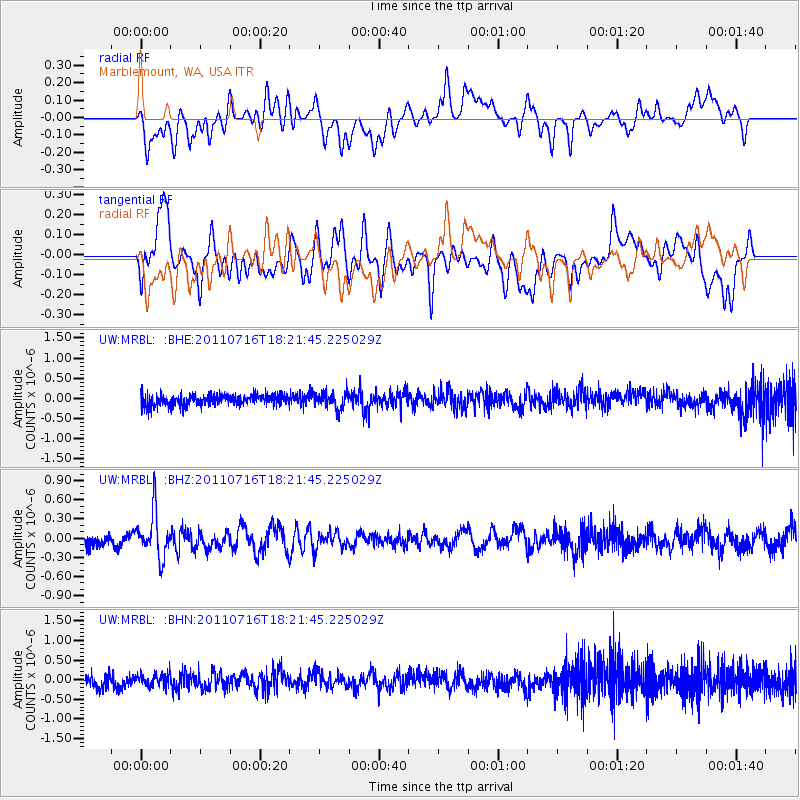
MRBL Marblemount, WA, USA - Earthquake Result Viewer
*The percent match for this event was below the threshold and hence no stack was calculated.
| Earthquake location: |
Vanuatu Islands |
| Earthquake latitude/longitude: |
-18.9/169.4 |
| Earthquake time(UTC): |
2011/07/16 (197) 18:09:40 GMT |
| Earthquake Depth: |
246 km |
| Earthquake Magnitude: |
5.5 MB, 5.7 MW, 5.6 MW |
| Earthquake Catalog/Contributor: |
WHDF/NEIC |
|
| Network: |
UW Pacific Northwest Regional Seismic Network |
| Station: |
MRBL Marblemount, WA, USA |
| Lat/Lon: |
48.52 N/121.48 W |
| Elevation: |
75 m |
|
| Distance: |
90.9 deg |
| Az: |
38.42 deg |
| Baz: |
242.257 deg |
| Ray Param: |
$rayparam |
*The percent match for this event was below the threshold and hence was not used in the summary stack. |
|
| Radial Match: |
58.87827 % |
| Radial Bump: |
400 |
| Transverse Match: |
48.219112 % |
| Transverse Bump: |
400 |
| SOD ConfigId: |
401841 |
| Insert Time: |
2011-12-21 02:10:56.924 +0000 |
| GWidth: |
2.5 |
| Max Bumps: |
400 |
| Tol: |
0.001 |
|
Signal To Noise
| Channel | StoN | STA | LTA |
| UW:MRBL: :BHZ:20110716T18:21:45.225029Z | 3.2689028 | 3.5876832E-7 | 1.0975191E-7 |
| UW:MRBL: :BHN:20110716T18:21:45.225029Z | 0.848916 | 1.552039E-7 | 1.8282599E-7 |
| UW:MRBL: :BHE:20110716T18:21:45.225029Z | 1.4452477 | 1.9428701E-7 | 1.3443164E-7 |
| Arrivals |
| Ps | |
| PpPs | |
| PsPs/PpSs | |


