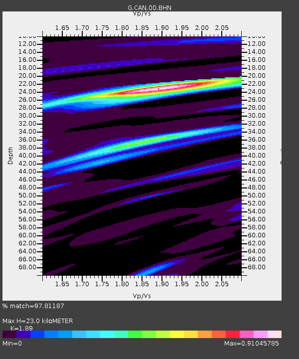
CAN Canberra, Australia - Earthquake Result Viewer
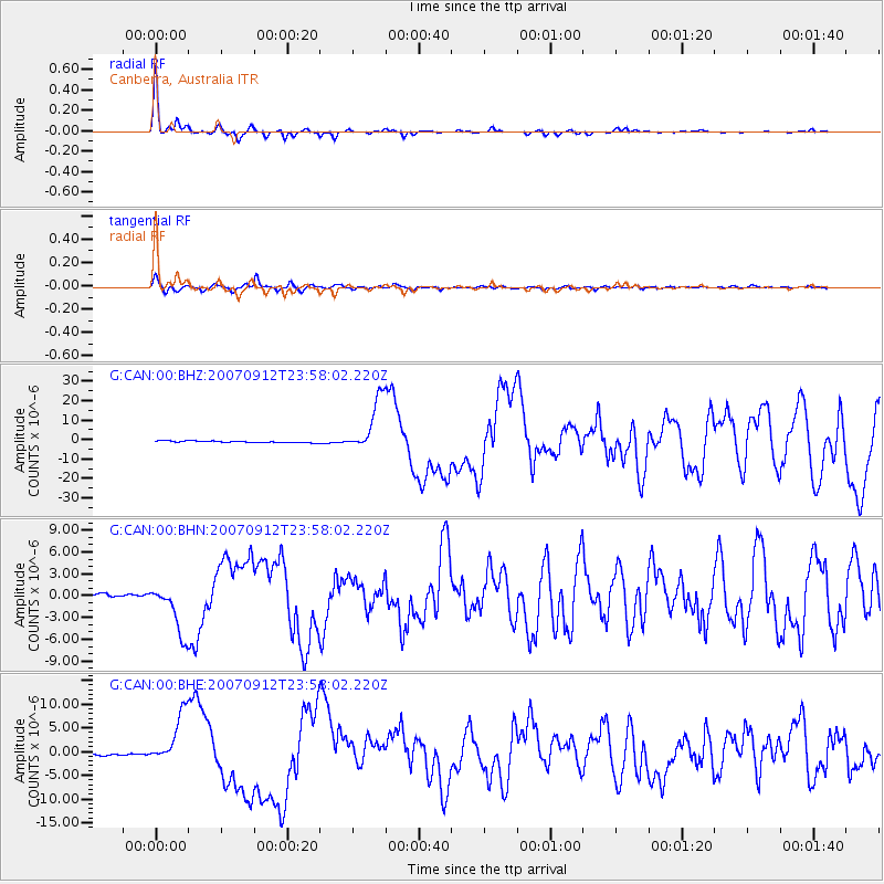
Earthquake location: Southern Sumatra, Indonesia
Earthquake latitude/longitude: -2.6/100.8
Earthquake time(UTC): 2007/09/12 (255) 23:49:03 GMT
Earthquake Depth: 35 km
Earthquake Magnitude: 6.6 MB, 8.1 MS, 7.9 MW, 7.6 ME
Earthquake Catalog/Contributor: WHDF/NEIC
Network: G GEOSCOPE
Station: CAN Canberra, Australia
Lat/Lon: 35.32 S/149.00 E
Elevation: 650 m
Distance: 55.2 deg
Az: 132.084 deg
Baz: 294.957 deg
Ray Param: 0.064902626
Estimated Moho Depth: 23.0 km
Estimated Crust Vp/Vs: 1.89
Assumed Crust Vp: 6.633 km/s
Estimated Crust Vs: 3.51 km/s
Estimated Crust Poisson's Ratio: 0.31
Radial Match: 97.81187 %
Radial Bump: 200
Transverse Match: 94.7349 %
Transverse Bump: 400
SOD ConfigId: 2564
Insert Time: 2010-02-26 21:42:20.127 +0000
GWidth: 2.5
Max Bumps: 400
Tol: 0.001

Signal To Noise

ChannelStoNSTALTA
G:CAN:00:BHN:20070912T23:58:02.220Z16.0519163.4925895E-62.1758085E-7
G:CAN:00:BHE:20070912T23:58:02.220Z21.9553245.345564E-62.4347463E-7
G:CAN:00:BHZ:20070912T23:58:02.220Z31.8082281.3698371E-54.3065495E-7
Arrivals
Ps3.3 SECOND
PpPs9.5 SECOND
PsPs/PpSs13 SECOND