You are here: Home > Network List > TA - USArray Transportable Network (new EarthScope stations) Stations List
> Station T36A Boggs Farm, Caney, KS, USA > Earthquake Result Viewer
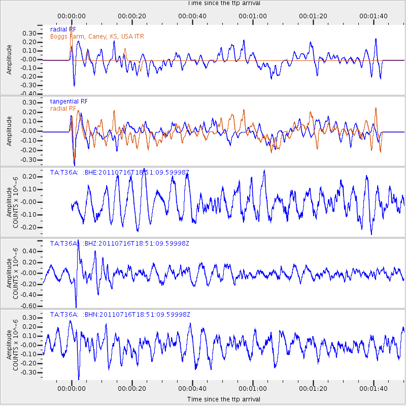
T36A Boggs Farm, Caney, KS, USA - Earthquake Result Viewer
*The percent match for this event was below the threshold and hence no stack was calculated.
| Earthquake location: |
Lake Baykal Region, Russia |
| Earthquake latitude/longitude: |
52.9/108.4 |
| Earthquake time(UTC): |
2011/07/16 (197) 18:38:50 GMT |
| Earthquake Depth: |
8.5 km |
| Earthquake Magnitude: |
5.5 MB, 5.3 MW, 5.3 MW |
| Earthquake Catalog/Contributor: |
WHDF/NEIC |
|
| Network: |
TA USArray Transportable Network (new EarthScope stations) |
| Station: |
T36A Boggs Farm, Caney, KS, USA |
| Lat/Lon: |
37.06 N/95.88 W |
| Elevation: |
243 m |
|
| Distance: |
88.0 deg |
| Az: |
19.247 deg |
| Baz: |
345.538 deg |
| Ray Param: |
$rayparam |
*The percent match for this event was below the threshold and hence was not used in the summary stack. |
|
| Radial Match: |
53.68209 % |
| Radial Bump: |
400 |
| Transverse Match: |
74.6377 % |
| Transverse Bump: |
400 |
| SOD ConfigId: |
401841 |
| Insert Time: |
2011-12-21 02:38:15.982 +0000 |
| GWidth: |
2.5 |
| Max Bumps: |
400 |
| Tol: |
0.001 |
|
Signal To Noise
| Channel | StoN | STA | LTA |
| TA:T36A: :BHZ:20110716T18:51:09.59998Z | 2.419539 | 2.6469985E-7 | 1.0940094E-7 |
| TA:T36A: :BHN:20110716T18:51:09.59998Z | 2.2984426 | 1.7830573E-7 | 7.757676E-8 |
| TA:T36A: :BHE:20110716T18:51:09.59998Z | 0.8518593 | 1.02711915E-7 | 1.205738E-7 |
| Arrivals |
| Ps | |
| PpPs | |
| PsPs/PpSs | |


