MPP McPhearson Peak - Earthquake Result Viewer
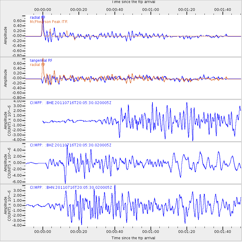
Earthquake location: Alaska Peninsula
Earthquake latitude/longitude: 54.8/-161.3
Earthquake time(UTC): 2011/07/16 (197) 19:59:12 GMT
Earthquake Depth: 36 km
Earthquake Magnitude: 6.3 MB, 5.9 MS, 6.2 MW, 6.1 MW
Earthquake Catalog/Contributor: WHDF/NEIC
Network: CI Caltech Regional Seismic Network
Station: MPP McPhearson Peak
Lat/Lon: 34.89 N/119.81 W
Elevation: 1739 m
Distance: 34.8 deg
Az: 107.559 deg
Baz: 317.798 deg
Ray Param: 0.07747331
Estimated Moho Depth: 14.25 km
Estimated Crust Vp/Vs: 1.96
Assumed Crust Vp: 6.1 km/s
Estimated Crust Vs: 3.116 km/s
Estimated Crust Poisson's Ratio: 0.32
Radial Match: 88.28266 %
Radial Bump: 400
Transverse Match: 66.57787 %
Transverse Bump: 400
SOD ConfigId: 401841
Insert Time: 2011-12-21 03:11:47.758 +0000
GWidth: 2.5
Max Bumps: 400
Tol: 0.001

Signal To Noise

ChannelStoNSTALTA
CI:MPP: :BHZ:20110716T20:05:30.020005Z5.17674887.159445E-71.3830004E-7
CI:MPP: :BHN:20110716T20:05:30.020005Z1.25330563.9555934E-73.1561285E-7
CI:MPP: :BHE:20110716T20:05:30.020005Z1.45588772.4036865E-71.651011E-7
Arrivals
Ps2.4 SECOND
PpPs6.5 SECOND
PsPs/PpSs8.9 SECOND