GMR Granite Mountains Research Center - Earthquake Result Viewer
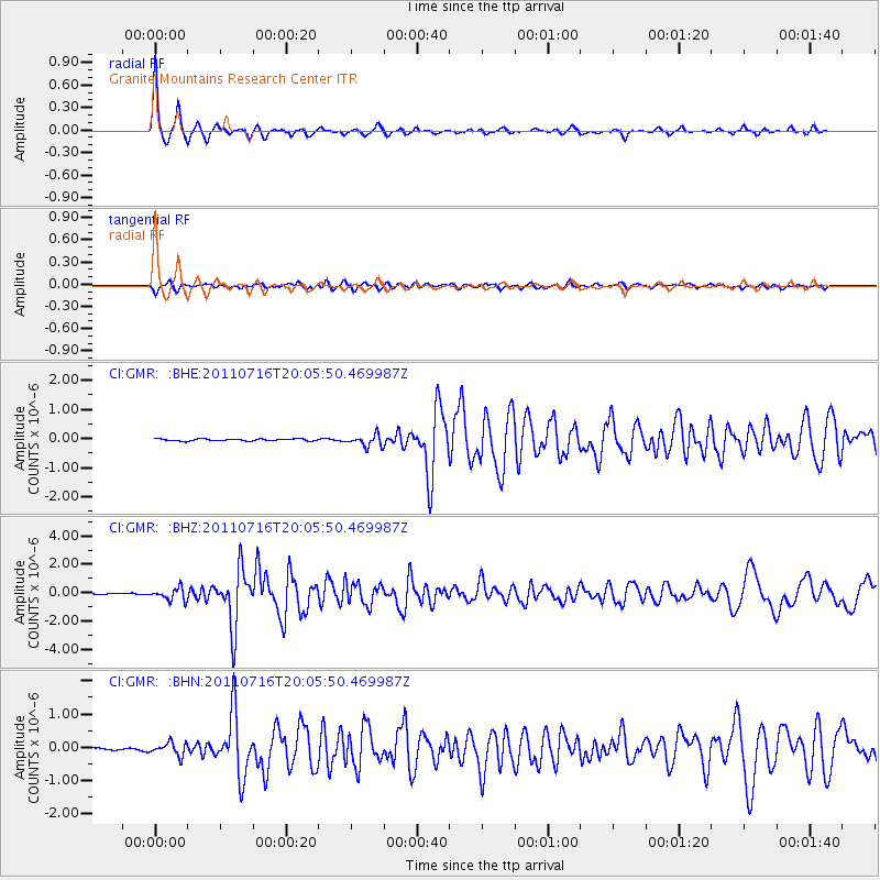
Earthquake location: Alaska Peninsula
Earthquake latitude/longitude: 54.8/-161.3
Earthquake time(UTC): 2011/07/16 (197) 19:59:12 GMT
Earthquake Depth: 36 km
Earthquake Magnitude: 6.3 MB, 5.9 MS, 6.2 MW, 6.1 MW
Earthquake Catalog/Contributor: WHDF/NEIC
Network: CI Caltech Regional Seismic Network
Station: GMR Granite Mountains Research Center
Lat/Lon: 34.78 N/115.66 W
Elevation: 1326 m
Distance: 37.2 deg
Az: 103.409 deg
Baz: 316.803 deg
Ray Param: 0.076184586
Estimated Moho Depth: 34.25 km
Estimated Crust Vp/Vs: 1.63
Assumed Crust Vp: 6.276 km/s
Estimated Crust Vs: 3.856 km/s
Estimated Crust Poisson's Ratio: 0.20
Radial Match: 92.91614 %
Radial Bump: 262
Transverse Match: 74.21854 %
Transverse Bump: 400
SOD ConfigId: 401841
Insert Time: 2011-12-21 03:13:18.919 +0000
GWidth: 2.5
Max Bumps: 400
Tol: 0.001

Signal To Noise

ChannelStoNSTALTA
CI:GMR: :BHZ:20110716T20:05:50.469987Z10.2018044.294759E-74.2098037E-8
CI:GMR: :BHN:20110716T20:05:50.469987Z3.95396521.9267195E-74.872879E-8
CI:GMR: :BHE:20110716T20:05:50.469987Z5.59886461.9906197E-73.5553988E-8
Arrivals
Ps3.7 SECOND
PpPs13 SECOND
PsPs/PpSs17 SECOND