You are here: Home > Network List > G - GEOSCOPE Stations List
> Station CLF Chambon la Foret observatory, France > Earthquake Result Viewer
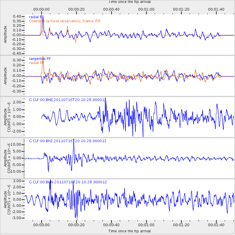
CLF Chambon la Foret observatory, France - Earthquake Result Viewer
*The percent match for this event was below the threshold and hence no stack was calculated.
| Earthquake location: |
Alaska Peninsula |
| Earthquake latitude/longitude: |
54.8/-161.3 |
| Earthquake time(UTC): |
2011/07/16 (197) 19:59:12 GMT |
| Earthquake Depth: |
36 km |
| Earthquake Magnitude: |
6.3 MB, 5.9 MS, 6.2 MW, 6.1 MW |
| Earthquake Catalog/Contributor: |
WHDF/NEIC |
|
| Network: |
G GEOSCOPE |
| Station: |
CLF Chambon la Foret observatory, France |
| Lat/Lon: |
48.03 N/2.26 E |
| Elevation: |
145 m |
|
| Distance: |
76.6 deg |
| Az: |
11.268 deg |
| Baz: |
350.294 deg |
| Ray Param: |
$rayparam |
*The percent match for this event was below the threshold and hence was not used in the summary stack. |
|
| Radial Match: |
71.565636 % |
| Radial Bump: |
400 |
| Transverse Match: |
61.521618 % |
| Transverse Bump: |
400 |
| SOD ConfigId: |
401841 |
| Insert Time: |
2011-12-21 03:15:08.413 +0000 |
| GWidth: |
2.5 |
| Max Bumps: |
400 |
| Tol: |
0.001 |
|
Signal To Noise
| Channel | StoN | STA | LTA |
| G:CLF:00:BHZ:20110716T20:10:28.90001Z | 12.670833 | 2.9352564E-6 | 2.3165458E-7 |
| G:CLF:00:BHN:20110716T20:10:28.90001Z | 1.7253621 | 1.1037197E-6 | 6.397032E-7 |
| G:CLF:00:BHE:20110716T20:10:28.90001Z | 1.607336 | 7.1255164E-7 | 4.4331216E-7 |
| Arrivals |
| Ps | |
| PpPs | |
| PsPs/PpSs | |


