You are here: Home > Network List > UW - Pacific Northwest Regional Seismic Network Stations List
> Station MRBL Marblemount, WA, USA > Earthquake Result Viewer
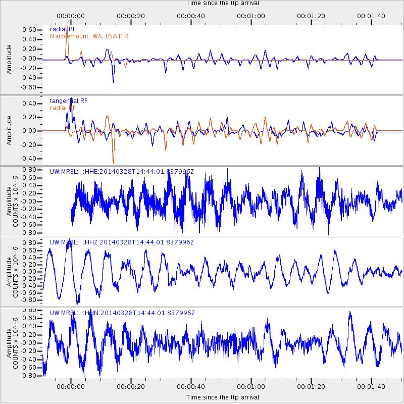
MRBL Marblemount, WA, USA - Earthquake Result Viewer
*The percent match for this event was below the threshold and hence no stack was calculated.
| Earthquake location: |
Near Coast Of Nicaragua |
| Earthquake latitude/longitude: |
11.6/-86.6 |
| Earthquake time(UTC): |
2014/03/28 (087) 14:36:08 GMT |
| Earthquake Depth: |
46 km |
| Earthquake Magnitude: |
5.6 MWW, 5.5 MWB, 5.6 MWC |
| Earthquake Catalog/Contributor: |
NEIC PDE/NEIC COMCAT |
|
| Network: |
UW Pacific Northwest Regional Seismic Network |
| Station: |
MRBL Marblemount, WA, USA |
| Lat/Lon: |
48.52 N/121.48 W |
| Elevation: |
75 m |
|
| Distance: |
46.9 deg |
| Az: |
328.549 deg |
| Baz: |
129.752 deg |
| Ray Param: |
$rayparam |
*The percent match for this event was below the threshold and hence was not used in the summary stack. |
|
| Radial Match: |
72.44823 % |
| Radial Bump: |
400 |
| Transverse Match: |
65.601814 % |
| Transverse Bump: |
400 |
| SOD ConfigId: |
3390531 |
| Insert Time: |
2019-04-10 22:30:46.206 +0000 |
| GWidth: |
2.5 |
| Max Bumps: |
400 |
| Tol: |
0.001 |
|
Signal To Noise
| Channel | StoN | STA | LTA |
| UW:MRBL: :HHZ:20140328T14:44:01.837996Z | 1.4514244 | 5.785429E-7 | 3.9860353E-7 |
| UW:MRBL: :HHN:20140328T14:44:01.837996Z | 1.3509492 | 4.2455622E-7 | 3.1426512E-7 |
| UW:MRBL: :HHE:20140328T14:44:01.837996Z | 1.3910135 | 3.3241903E-7 | 2.3897613E-7 |
| Arrivals |
| Ps | |
| PpPs | |
| PsPs/PpSs | |


