You are here: Home > Network List > TA - USArray Transportable Network (new EarthScope stations) Stations List
> Station 241A Mo Tay, Goldonna, LA, USA > Earthquake Result Viewer
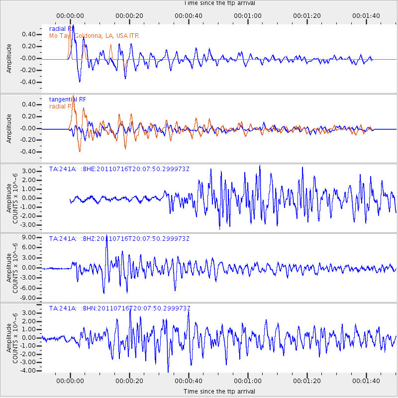
241A Mo Tay, Goldonna, LA, USA - Earthquake Result Viewer

| Earthquake location: |
Alaska Peninsula |
| Earthquake latitude/longitude: |
54.8/-161.3 |
| Earthquake time(UTC): |
2011/07/16 (197) 19:59:12 GMT |
| Earthquake Depth: |
36 km |
| Earthquake Magnitude: |
6.3 MB, 5.9 MS, 6.2 MW, 6.1 MW |
| Earthquake Catalog/Contributor: |
WHDF/NEIC |
|
| Network: |
TA USArray Transportable Network (new EarthScope stations) |
| Station: |
241A Mo Tay, Goldonna, LA, USA |
| Lat/Lon: |
32.02 N/92.92 W |
| Elevation: |
59 m |
|
| Distance: |
52.3 deg |
| Az: |
86.347 deg |
| Baz: |
317.118 deg |
| Ray Param: |
0.06677717 |
| Estimated Moho Depth: |
44.0 km |
| Estimated Crust Vp/Vs: |
1.63 |
| Assumed Crust Vp: |
6.245 km/s |
| Estimated Crust Vs: |
3.82 km/s |
| Estimated Crust Poisson's Ratio: |
0.20 |
|
| Radial Match: |
94.144226 % |
| Radial Bump: |
400 |
| Transverse Match: |
84.394066 % |
| Transverse Bump: |
400 |
| SOD ConfigId: |
401841 |
| Insert Time: |
2011-12-21 04:03:56.323 +0000 |
| GWidth: |
2.5 |
| Max Bumps: |
400 |
| Tol: |
0.001 |
|
Signal To Noise
| Channel | StoN | STA | LTA |
| TA:241A: :BHZ:20110716T20:07:50.299973Z | 15.11033 | 1.3899139E-6 | 9.1984354E-8 |
| TA:241A: :BHN:20110716T20:07:50.299973Z | 5.0062203 | 5.4206157E-7 | 1.0827761E-7 |
| TA:241A: :BHE:20110716T20:07:50.299973Z | 3.163378 | 6.1415415E-7 | 1.9414503E-7 |
| Arrivals |
| Ps | 4.7 SECOND |
| PpPs | 18 SECOND |
| PsPs/PpSs | 22 SECOND |


