You are here: Home > Network List > TA - USArray Transportable Network (new EarthScope stations) Stations List
> Station X44A Crenshaw, MS, USA > Earthquake Result Viewer
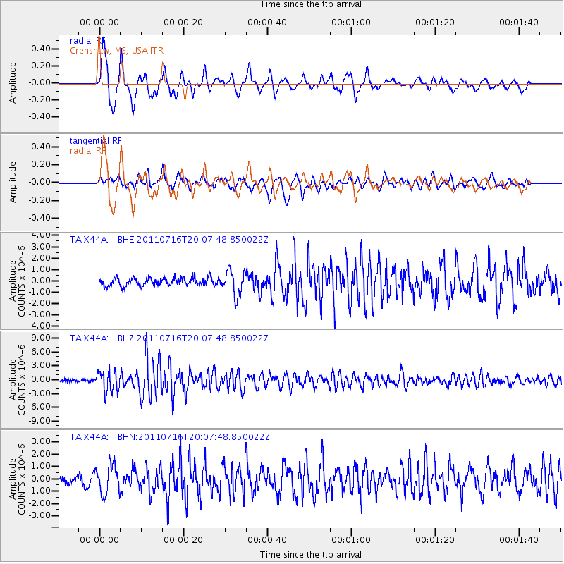
X44A Crenshaw, MS, USA - Earthquake Result Viewer
*The percent match for this event was below the threshold and hence no stack was calculated.
| Earthquake location: |
Alaska Peninsula |
| Earthquake latitude/longitude: |
54.8/-161.3 |
| Earthquake time(UTC): |
2011/07/16 (197) 19:59:12 GMT |
| Earthquake Depth: |
36 km |
| Earthquake Magnitude: |
6.3 MB, 5.9 MS, 6.2 MW, 6.1 MW |
| Earthquake Catalog/Contributor: |
WHDF/NEIC |
|
| Network: |
TA USArray Transportable Network (new EarthScope stations) |
| Station: |
X44A Crenshaw, MS, USA |
| Lat/Lon: |
34.50 N/90.15 W |
| Elevation: |
109 m |
|
| Distance: |
52.1 deg |
| Az: |
82.063 deg |
| Baz: |
316.006 deg |
| Ray Param: |
$rayparam |
*The percent match for this event was below the threshold and hence was not used in the summary stack. |
|
| Radial Match: |
77.103485 % |
| Radial Bump: |
400 |
| Transverse Match: |
81.3776 % |
| Transverse Bump: |
400 |
| SOD ConfigId: |
401841 |
| Insert Time: |
2011-12-21 04:10:25.585 +0000 |
| GWidth: |
2.5 |
| Max Bumps: |
400 |
| Tol: |
0.001 |
|
Signal To Noise
| Channel | StoN | STA | LTA |
| TA:X44A: :BHZ:20110716T20:07:48.850022Z | 10.770421 | 2.1714436E-6 | 2.0161178E-7 |
| TA:X44A: :BHN:20110716T20:07:48.850022Z | 3.0455601 | 1.1706456E-6 | 3.8437778E-7 |
| TA:X44A: :BHE:20110716T20:07:48.850022Z | 3.3725991 | 1.0655614E-6 | 3.1594666E-7 |
| Arrivals |
| Ps | |
| PpPs | |
| PsPs/PpSs | |


