You are here: Home > Network List > CI - Caltech Regional Seismic Network Stations List
> Station LGU LGU, Camarillo, CA, USA > Earthquake Result Viewer
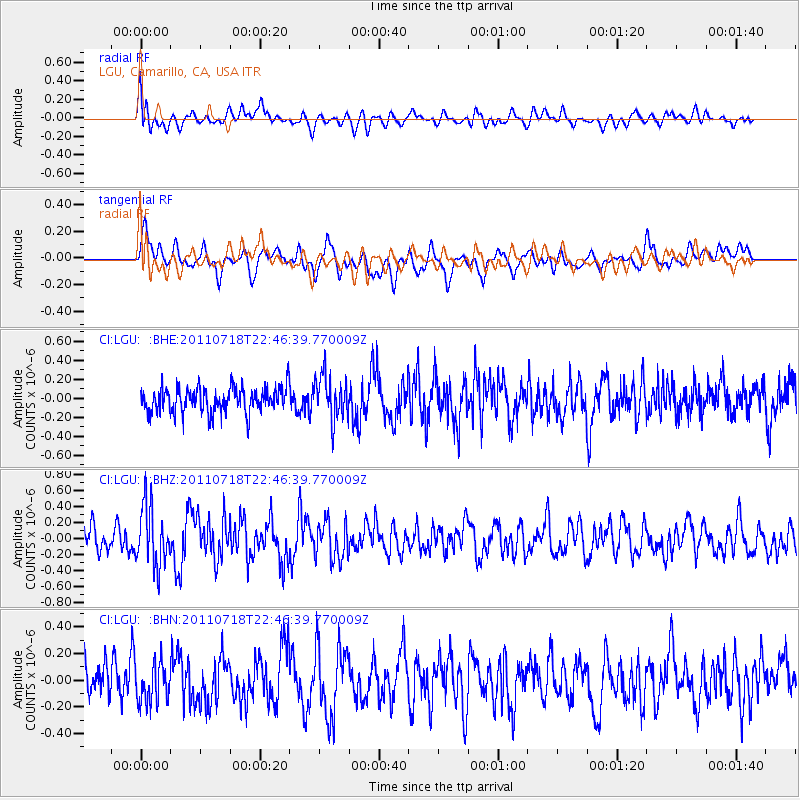
LGU LGU, Camarillo, CA, USA - Earthquake Result Viewer
*The percent match for this event was below the threshold and hence no stack was calculated.
| Earthquake location: |
Rat Islands, Aleutian Islands |
| Earthquake latitude/longitude: |
51.3/178.9 |
| Earthquake time(UTC): |
2011/07/18 (199) 22:38:38 GMT |
| Earthquake Depth: |
19 km |
| Earthquake Magnitude: |
5.8 MW, 5.3 MS, 5.4 MB, 5.8 MW |
| Earthquake Catalog/Contributor: |
WHDF/NEIC |
|
| Network: |
CI Caltech Regional Seismic Network |
| Station: |
LGU LGU, Camarillo, CA, USA |
| Lat/Lon: |
34.11 N/119.07 W |
| Elevation: |
416 m |
|
| Distance: |
47.2 deg |
| Az: |
86.301 deg |
| Baz: |
310.941 deg |
| Ray Param: |
$rayparam |
*The percent match for this event was below the threshold and hence was not used in the summary stack. |
|
| Radial Match: |
52.932125 % |
| Radial Bump: |
400 |
| Transverse Match: |
59.78476 % |
| Transverse Bump: |
400 |
| SOD ConfigId: |
401841 |
| Insert Time: |
2011-12-21 04:29:23.140 +0000 |
| GWidth: |
2.5 |
| Max Bumps: |
400 |
| Tol: |
0.001 |
|
Signal To Noise
| Channel | StoN | STA | LTA |
| CI:LGU: :BHZ:20110718T22:46:39.770009Z | 2.8909538 | 3.7650392E-7 | 1.302352E-7 |
| CI:LGU: :BHN:20110718T22:46:39.770009Z | 1.0514846 | 1.5455068E-7 | 1.4698331E-7 |
| CI:LGU: :BHE:20110718T22:46:39.770009Z | 1.7681541 | 2.3247219E-7 | 1.3147734E-7 |
| Arrivals |
| Ps | |
| PpPs | |
| PsPs/PpSs | |


