You are here: Home > Network List > TA - USArray Transportable Network (new EarthScope stations) Stations List
> Station TUL1 Leonard, OK, USA > Earthquake Result Viewer
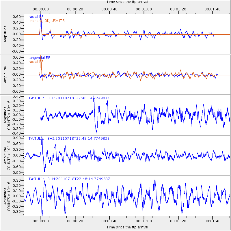
TUL1 Leonard, OK, USA - Earthquake Result Viewer
*The percent match for this event was below the threshold and hence no stack was calculated.
| Earthquake location: |
Rat Islands, Aleutian Islands |
| Earthquake latitude/longitude: |
51.3/178.9 |
| Earthquake time(UTC): |
2011/07/18 (199) 22:38:38 GMT |
| Earthquake Depth: |
19 km |
| Earthquake Magnitude: |
5.8 MW, 5.3 MS, 5.4 MB, 5.8 MW |
| Earthquake Catalog/Contributor: |
WHDF/NEIC |
|
| Network: |
TA USArray Transportable Network (new EarthScope stations) |
| Station: |
TUL1 Leonard, OK, USA |
| Lat/Lon: |
35.91 N/95.79 W |
| Elevation: |
256 m |
|
| Distance: |
60.2 deg |
| Az: |
68.751 deg |
| Baz: |
313.856 deg |
| Ray Param: |
$rayparam |
*The percent match for this event was below the threshold and hence was not used in the summary stack. |
|
| Radial Match: |
72.08129 % |
| Radial Bump: |
400 |
| Transverse Match: |
58.398537 % |
| Transverse Bump: |
400 |
| SOD ConfigId: |
401841 |
| Insert Time: |
2011-12-21 04:45:49.254 +0000 |
| GWidth: |
2.5 |
| Max Bumps: |
400 |
| Tol: |
0.001 |
|
Signal To Noise
| Channel | StoN | STA | LTA |
| TA:TUL1: :BHZ:20110718T22:48:14.774983Z | 6.3551545 | 4.2340906E-7 | 6.6624516E-8 |
| TA:TUL1: :BHN:20110718T22:48:14.774983Z | 3.063647 | 1.6532832E-7 | 5.3964545E-8 |
| TA:TUL1: :BHE:20110718T22:48:14.774983Z | 4.3935266 | 2.0739486E-7 | 4.7204647E-8 |
| Arrivals |
| Ps | |
| PpPs | |
| PsPs/PpSs | |


