You are here: Home > Network List > TA - USArray Transportable Network (new EarthScope stations) Stations List
> Station K30A Basset, NE, USA > Earthquake Result Viewer
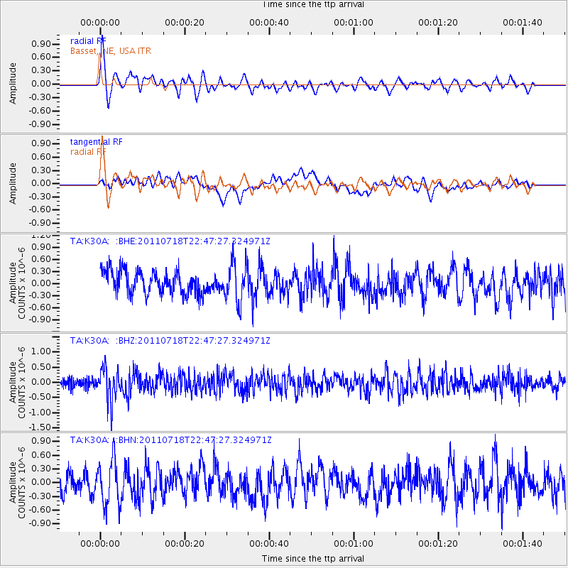
K30A Basset, NE, USA - Earthquake Result Viewer
*The percent match for this event was below the threshold and hence no stack was calculated.
| Earthquake location: |
Rat Islands, Aleutian Islands |
| Earthquake latitude/longitude: |
51.3/178.9 |
| Earthquake time(UTC): |
2011/07/18 (199) 22:38:38 GMT |
| Earthquake Depth: |
19 km |
| Earthquake Magnitude: |
5.8 MW, 5.3 MS, 5.4 MB, 5.8 MW |
| Earthquake Catalog/Contributor: |
WHDF/NEIC |
|
| Network: |
TA USArray Transportable Network (new EarthScope stations) |
| Station: |
K30A Basset, NE, USA |
| Lat/Lon: |
42.67 N/99.61 W |
| Elevation: |
712 m |
|
| Distance: |
53.5 deg |
| Az: |
65.083 deg |
| Baz: |
309.433 deg |
| Ray Param: |
$rayparam |
*The percent match for this event was below the threshold and hence was not used in the summary stack. |
|
| Radial Match: |
58.49116 % |
| Radial Bump: |
400 |
| Transverse Match: |
54.471867 % |
| Transverse Bump: |
400 |
| SOD ConfigId: |
401841 |
| Insert Time: |
2011-12-21 04:47:25.646 +0000 |
| GWidth: |
2.5 |
| Max Bumps: |
400 |
| Tol: |
0.001 |
|
Signal To Noise
| Channel | StoN | STA | LTA |
| TA:K30A: :BHZ:20110718T22:47:27.324971Z | 3.6087132 | 5.3279047E-7 | 1.4764001E-7 |
| TA:K30A: :BHN:20110718T22:47:27.324971Z | 2.1225255 | 4.961332E-7 | 2.3374668E-7 |
| TA:K30A: :BHE:20110718T22:47:27.324971Z | 1.7343957 | 4.9073236E-7 | 2.829414E-7 |
| Arrivals |
| Ps | |
| PpPs | |
| PsPs/PpSs | |


