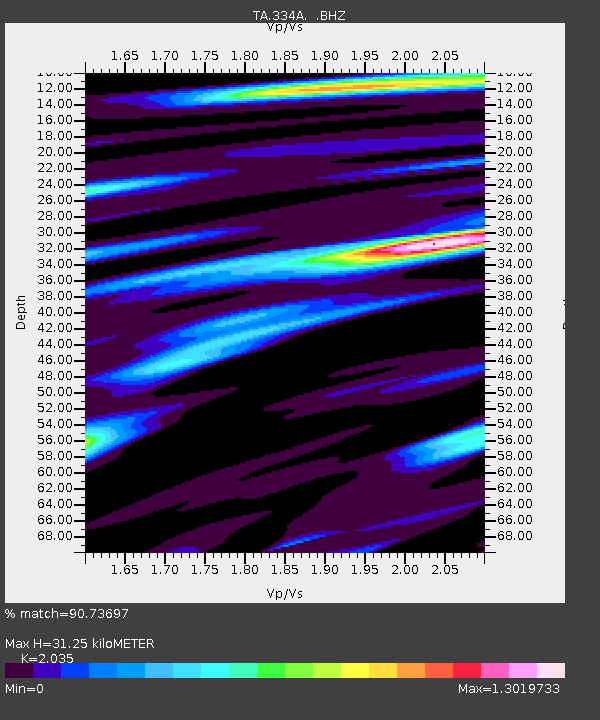
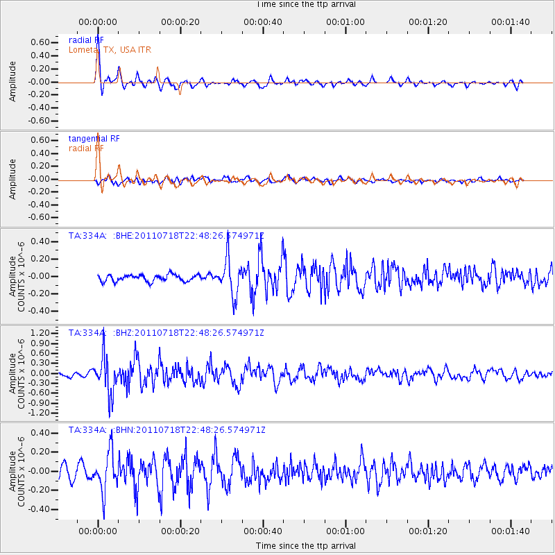
334A Lometa, TX, USA - Earthquake Result Viewer

Earthquake location: Rat Islands, Aleutian Islands
Earthquake latitude/longitude: 51.3/178.9
Earthquake time(UTC): 2011/07/18 (199) 22:38:38 GMT
Earthquake Depth: 19 km
Earthquake Magnitude: 5.8 MW, 5.3 MS, 5.4 MB, 5.8 MW
Earthquake Catalog/Contributor: WHDF/NEIC
Network: TA USArray Transportable Network (new EarthScope stations)
Station: 334A Lometa, TX, USA
Lat/Lon: 31.33 N/98.24 W
Elevation: 389 m
Distance: 62.0 deg
Az: 74.106 deg
Baz: 315.096 deg
Ray Param: 0.060512513
Estimated Moho Depth: 31.25 km
Estimated Crust Vp/Vs: 2.04
Assumed Crust Vp: 6.498 km/s
Estimated Crust Vs: 3.193 km/s
Estimated Crust Poisson's Ratio: 0.34
Radial Match: 90.73697 %
Radial Bump: 400
Transverse Match: 63.295776 %
Transverse Bump: 400
SOD ConfigId: 401841
Insert Time: 2011-12-21 04:52:04.077 +0000
GWidth: 2.5
Max Bumps: 400
Tol: 0.001

Signal To Noise

ChannelStoNSTALTA
TA:334A: :BHZ:20110718T22:48:26.574971Z10.8419045.7329254E-75.2877482E-8
TA:334A: :BHN:20110718T22:48:26.574971Z3.78137042.1376343E-75.6530677E-8
TA:334A: :BHE:20110718T22:48:26.574971Z5.74993942.1686084E-73.7715328E-8
Arrivals
Ps5.2 SECOND
PpPs14 SECOND
PsPs/PpSs19 SECOND