
535A Dale, TX, USA - Earthquake Result Viewer
| ||||||||||||||||||
| ||||||||||||||||||
| ||||||||||||||||||
|
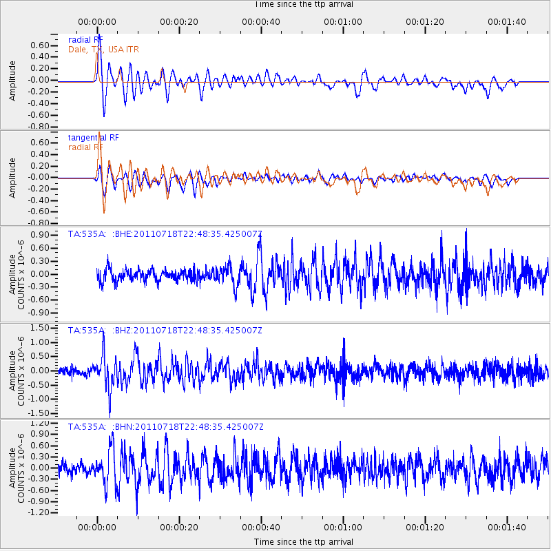
Signal To Noise
| Channel | StoN | STA | LTA |
| TA:535A: :BHZ:20110718T22:48:35.425007Z | 6.3537536 | 5.8368465E-7 | 9.186454E-8 |
| TA:535A: :BHN:20110718T22:48:35.425007Z | 3.870997 | 4.795342E-7 | 1.2387873E-7 |
| TA:535A: :BHE:20110718T22:48:35.425007Z | 1.8162117 | 2.3024086E-7 | 1.2676983E-7 |
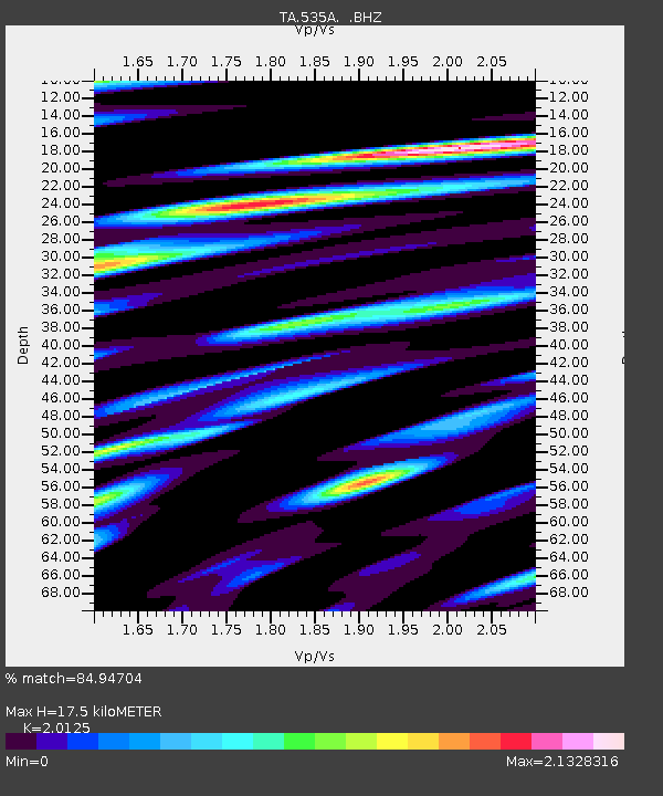
| Arrivals | |
| Ps | 2.9 SECOND |
| PpPs | 8.0 SECOND |
| PsPs/PpSs | 11 SECOND |

