You are here: Home > Network List > TA - USArray Transportable Network (new EarthScope stations) Stations List
> Station 635A Leesville, TX, USA > Earthquake Result Viewer
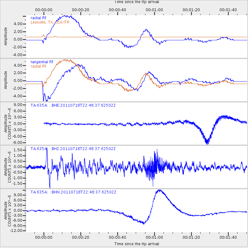
635A Leesville, TX, USA - Earthquake Result Viewer
*The percent match for this event was below the threshold and hence no stack was calculated.
| Earthquake location: |
Rat Islands, Aleutian Islands |
| Earthquake latitude/longitude: |
51.3/178.9 |
| Earthquake time(UTC): |
2011/07/18 (199) 22:38:38 GMT |
| Earthquake Depth: |
19 km |
| Earthquake Magnitude: |
5.8 MW, 5.3 MS, 5.4 MB, 5.8 MW |
| Earthquake Catalog/Contributor: |
WHDF/NEIC |
|
| Network: |
TA USArray Transportable Network (new EarthScope stations) |
| Station: |
635A Leesville, TX, USA |
| Lat/Lon: |
29.39 N/97.77 W |
| Elevation: |
119 m |
|
| Distance: |
63.6 deg |
| Az: |
75.312 deg |
| Baz: |
315.881 deg |
| Ray Param: |
$rayparam |
*The percent match for this event was below the threshold and hence was not used in the summary stack. |
|
| Radial Match: |
48.930508 % |
| Radial Bump: |
400 |
| Transverse Match: |
46.45206 % |
| Transverse Bump: |
400 |
| SOD ConfigId: |
401841 |
| Insert Time: |
2011-12-21 04:53:38.645 +0000 |
| GWidth: |
2.5 |
| Max Bumps: |
400 |
| Tol: |
0.001 |
|
Signal To Noise
| Channel | StoN | STA | LTA |
| TA:635A: :BHZ:20110718T22:48:37.62502Z | 6.4890437 | 7.345606E-7 | 1.1320014E-7 |
| TA:635A: :BHN:20110718T22:48:37.62502Z | 0.93070614 | 5.6785603E-7 | 6.1013463E-7 |
| TA:635A: :BHE:20110718T22:48:37.62502Z | 1.4373038 | 2.870824E-7 | 1.9973677E-7 |
| Arrivals |
| Ps | |
| PpPs | |
| PsPs/PpSs | |


