Q34A Chapman, KS, USA - Earthquake Result Viewer
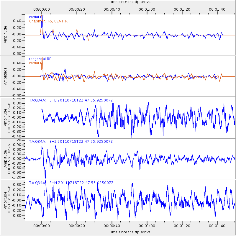
Earthquake location: Rat Islands, Aleutian Islands
Earthquake latitude/longitude: 51.3/178.9
Earthquake time(UTC): 2011/07/18 (199) 22:38:38 GMT
Earthquake Depth: 19 km
Earthquake Magnitude: 5.8 MW, 5.3 MS, 5.4 MB, 5.8 MW
Earthquake Catalog/Contributor: WHDF/NEIC
Network: TA USArray Transportable Network (new EarthScope stations)
Station: Q34A Chapman, KS, USA
Lat/Lon: 38.92 N/96.94 W
Elevation: 378 m
Distance: 57.5 deg
Az: 66.914 deg
Baz: 312.211 deg
Ray Param: 0.06342309
Estimated Moho Depth: 14.5 km
Estimated Crust Vp/Vs: 2.07
Assumed Crust Vp: 6.483 km/s
Estimated Crust Vs: 3.132 km/s
Estimated Crust Poisson's Ratio: 0.35
Radial Match: 84.72855 %
Radial Bump: 400
Transverse Match: 67.104355 %
Transverse Bump: 400
SOD ConfigId: 401841
Insert Time: 2011-12-21 04:59:29.077 +0000
GWidth: 2.5
Max Bumps: 400
Tol: 0.001

Signal To Noise

ChannelStoNSTALTA
TA:Q34A: :BHZ:20110718T22:47:55.925007Z7.30863245.0861394E-76.9590854E-8
TA:Q34A: :BHN:20110718T22:47:55.925007Z2.76765011.9074417E-76.891918E-8
TA:Q34A: :BHE:20110718T22:47:55.925007Z2.73243621.8603326E-76.8083295E-8
Arrivals
Ps2.5 SECOND
PpPs6.6 SECOND
PsPs/PpSs9.1 SECOND