You are here: Home > Network List > TA - USArray Transportable Network (new EarthScope stations) Stations List
> Station P38A Dawn, MO, USA > Earthquake Result Viewer
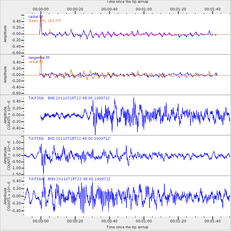
P38A Dawn, MO, USA - Earthquake Result Viewer
*The percent match for this event was below the threshold and hence no stack was calculated.
| Earthquake location: |
Rat Islands, Aleutian Islands |
| Earthquake latitude/longitude: |
51.3/178.9 |
| Earthquake time(UTC): |
2011/07/18 (199) 22:38:38 GMT |
| Earthquake Depth: |
19 km |
| Earthquake Magnitude: |
5.8 MW, 5.3 MS, 5.4 MB, 5.8 MW |
| Earthquake Catalog/Contributor: |
WHDF/NEIC |
|
| Network: |
TA USArray Transportable Network (new EarthScope stations) |
| Station: |
P38A Dawn, MO, USA |
| Lat/Lon: |
39.62 N/93.53 W |
| Elevation: |
248 m |
|
| Distance: |
59.0 deg |
| Az: |
64.201 deg |
| Baz: |
312.933 deg |
| Ray Param: |
$rayparam |
*The percent match for this event was below the threshold and hence was not used in the summary stack. |
|
| Radial Match: |
71.277794 % |
| Radial Bump: |
400 |
| Transverse Match: |
40.03084 % |
| Transverse Bump: |
400 |
| SOD ConfigId: |
401841 |
| Insert Time: |
2011-12-21 05:12:47.770 +0000 |
| GWidth: |
2.5 |
| Max Bumps: |
400 |
| Tol: |
0.001 |
|
Signal To Noise
| Channel | StoN | STA | LTA |
| TA:P38A: :BHZ:20110718T22:48:06.199971Z | 10.077104 | 5.165477E-7 | 5.1259537E-8 |
| TA:P38A: :BHN:20110718T22:48:06.199971Z | 1.9917048 | 1.9793117E-7 | 9.9377765E-8 |
| TA:P38A: :BHE:20110718T22:48:06.199971Z | 4.863889 | 2.1704813E-7 | 4.46244E-8 |
| Arrivals |
| Ps | |
| PpPs | |
| PsPs/PpSs | |


