You are here: Home > Network List > TA - USArray Transportable Network (new EarthScope stations) Stations List
> Station R38A Fenwick Farm, Montrose, MO, USA > Earthquake Result Viewer
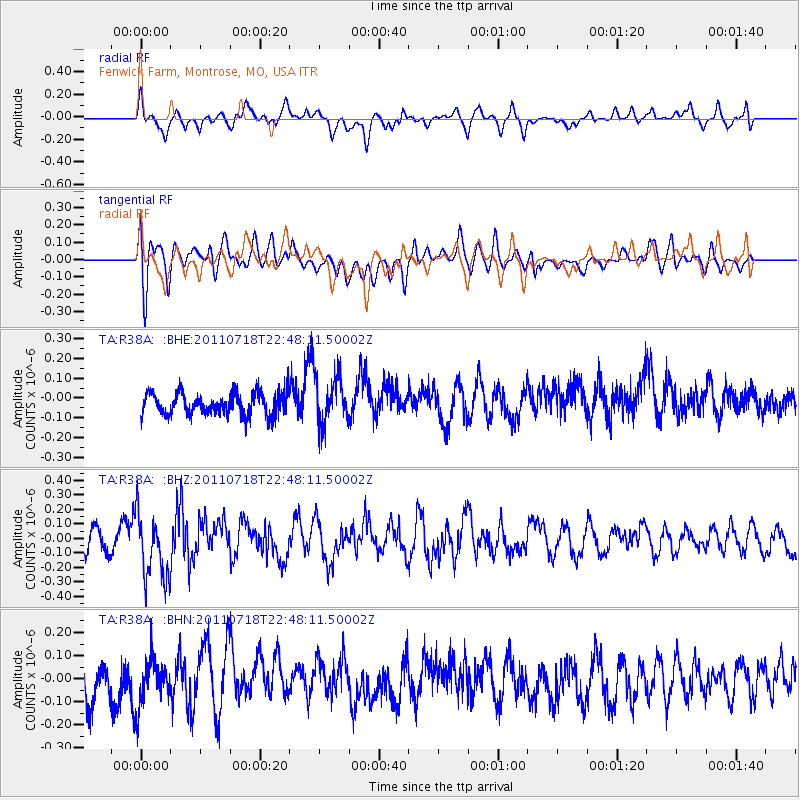
R38A Fenwick Farm, Montrose, MO, USA - Earthquake Result Viewer
*The percent match for this event was below the threshold and hence no stack was calculated.
| Earthquake location: |
Rat Islands, Aleutian Islands |
| Earthquake latitude/longitude: |
51.3/178.9 |
| Earthquake time(UTC): |
2011/07/18 (199) 22:38:38 GMT |
| Earthquake Depth: |
19 km |
| Earthquake Magnitude: |
5.8 MW, 5.3 MS, 5.4 MB, 5.8 MW |
| Earthquake Catalog/Contributor: |
WHDF/NEIC |
|
| Network: |
TA USArray Transportable Network (new EarthScope stations) |
| Station: |
R38A Fenwick Farm, Montrose, MO, USA |
| Lat/Lon: |
38.19 N/93.91 W |
| Elevation: |
237 m |
|
| Distance: |
59.8 deg |
| Az: |
65.65 deg |
| Baz: |
313.437 deg |
| Ray Param: |
$rayparam |
*The percent match for this event was below the threshold and hence was not used in the summary stack. |
|
| Radial Match: |
56.615955 % |
| Radial Bump: |
400 |
| Transverse Match: |
54.20982 % |
| Transverse Bump: |
400 |
| SOD ConfigId: |
401841 |
| Insert Time: |
2011-12-21 05:13:14.846 +0000 |
| GWidth: |
2.5 |
| Max Bumps: |
400 |
| Tol: |
0.001 |
|
Signal To Noise
| Channel | StoN | STA | LTA |
| TA:R38A: :BHZ:20110718T22:48:11.50002Z | 3.3140087 | 2.2601186E-7 | 6.8198936E-8 |
| TA:R38A: :BHN:20110718T22:48:11.50002Z | 1.2371471 | 9.517249E-8 | 7.6929E-8 |
| TA:R38A: :BHE:20110718T22:48:11.50002Z | 2.2098606 | 1.2091846E-7 | 5.4717688E-8 |
| Arrivals |
| Ps | |
| PpPs | |
| PsPs/PpSs | |


