You are here: Home > Network List > UW - Pacific Northwest Regional Seismic Network Stations List
> Station UMAT Pilot Rock, OR, USA > Earthquake Result Viewer
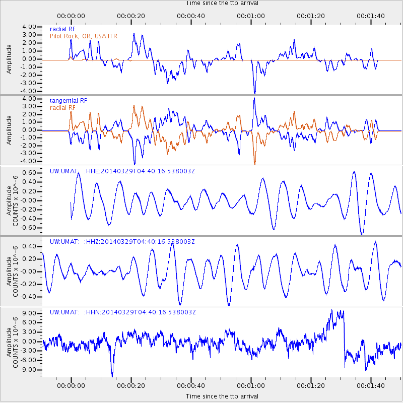
UMAT Pilot Rock, OR, USA - Earthquake Result Viewer
*The percent match for this event was below the threshold and hence no stack was calculated.
| Earthquake location: |
South Of Kermadec Islands |
| Earthquake latitude/longitude: |
-34.6/179.7 |
| Earthquake time(UTC): |
2014/03/29 (088) 04:27:50 GMT |
| Earthquake Depth: |
300 km |
| Earthquake Magnitude: |
4.0 mb |
| Earthquake Catalog/Contributor: |
ISC/ISC |
|
| Network: |
UW Pacific Northwest Regional Seismic Network |
| Station: |
UMAT Pilot Rock, OR, USA |
| Lat/Lon: |
45.29 N/118.96 W |
| Elevation: |
1318 m |
|
| Distance: |
96.9 deg |
| Az: |
38.586 deg |
| Baz: |
226.821 deg |
| Ray Param: |
$rayparam |
*The percent match for this event was below the threshold and hence was not used in the summary stack. |
|
| Radial Match: |
29.66913 % |
| Radial Bump: |
400 |
| Transverse Match: |
29.045235 % |
| Transverse Bump: |
400 |
| SOD ConfigId: |
3390531 |
| Insert Time: |
2019-04-10 22:52:46.975 +0000 |
| GWidth: |
2.5 |
| Max Bumps: |
400 |
| Tol: |
0.001 |
|
Signal To Noise
| Channel | StoN | STA | LTA |
| UW:UMAT: :HHZ:20140329T04:40:16.538003Z | 0.2746021 | 8.203905E-8 | 2.987561E-7 |
| UW:UMAT: :HHN:20140329T04:40:16.538003Z | 0.5034625 | 1.8551599E-6 | 3.6848026E-6 |
| UW:UMAT: :HHE:20140329T04:40:16.538003Z | 0.69170237 | 2.0150144E-7 | 2.9131232E-7 |
| Arrivals |
| Ps | |
| PpPs | |
| PsPs/PpSs | |


