Y41A Eaglette Bearden, AR, USA - Earthquake Result Viewer
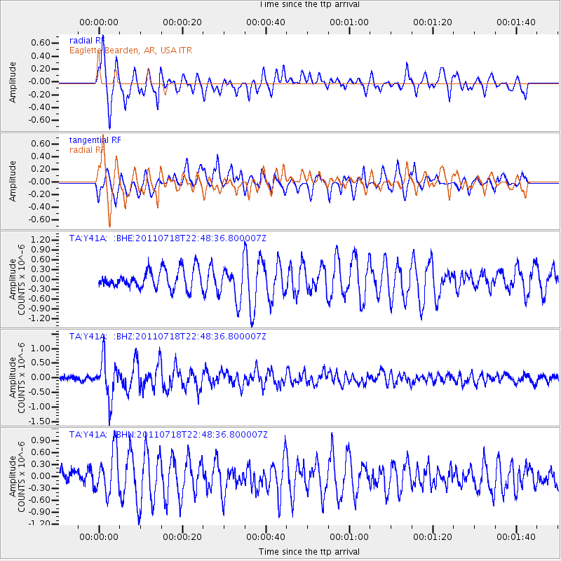
Earthquake location: Rat Islands, Aleutian Islands
Earthquake latitude/longitude: 51.3/178.9
Earthquake time(UTC): 2011/07/18 (199) 22:38:38 GMT
Earthquake Depth: 19 km
Earthquake Magnitude: 5.8 MW, 5.3 MS, 5.4 MB, 5.8 MW
Earthquake Catalog/Contributor: WHDF/NEIC
Network: TA USArray Transportable Network (new EarthScope stations)
Station: Y41A Eaglette Bearden, AR, USA
Lat/Lon: 33.88 N/92.61 W
Elevation: 99 m
Distance: 63.5 deg
Az: 68.3 deg
Baz: 315.456 deg
Ray Param: 0.05950801
Estimated Moho Depth: 36.0 km
Estimated Crust Vp/Vs: 1.70
Assumed Crust Vp: 6.245 km/s
Estimated Crust Vs: 3.668 km/s
Estimated Crust Poisson's Ratio: 0.24
Radial Match: 83.31265 %
Radial Bump: 400
Transverse Match: 74.15 %
Transverse Bump: 400
SOD ConfigId: 401841
Insert Time: 2011-12-21 05:21:42.211 +0000
GWidth: 2.5
Max Bumps: 400
Tol: 0.001

Signal To Noise

ChannelStoNSTALTA
TA:Y41A: :BHZ:20110718T22:48:36.800007Z6.9854586.7388925E-79.64703E-8
TA:Y41A: :BHN:20110718T22:48:36.800007Z2.32631185.5762257E-72.3970242E-7
TA:Y41A: :BHE:20110718T22:48:36.800007Z1.86815015.326012E-72.850955E-7
Arrivals
Ps4.2 SECOND
PpPs15 SECOND
PsPs/PpSs19 SECOND