You are here: Home > Network List > TA - USArray Transportable Network (new EarthScope stations) Stations List
> Station Q42A Golden Eagle, IL, USA > Earthquake Result Viewer
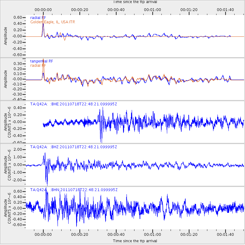
Q42A Golden Eagle, IL, USA - Earthquake Result Viewer
*The percent match for this event was below the threshold and hence no stack was calculated.
| Earthquake location: |
Rat Islands, Aleutian Islands |
| Earthquake latitude/longitude: |
51.3/178.9 |
| Earthquake time(UTC): |
2011/07/18 (199) 22:38:38 GMT |
| Earthquake Depth: |
19 km |
| Earthquake Magnitude: |
5.8 MW, 5.3 MS, 5.4 MB, 5.8 MW |
| Earthquake Catalog/Contributor: |
WHDF/NEIC |
|
| Network: |
TA USArray Transportable Network (new EarthScope stations) |
| Station: |
Q42A Golden Eagle, IL, USA |
| Lat/Lon: |
38.91 N/90.53 W |
| Elevation: |
175 m |
|
| Distance: |
61.2 deg |
| Az: |
62.945 deg |
| Baz: |
314.197 deg |
| Ray Param: |
$rayparam |
*The percent match for this event was below the threshold and hence was not used in the summary stack. |
|
| Radial Match: |
61.624104 % |
| Radial Bump: |
400 |
| Transverse Match: |
50.646366 % |
| Transverse Bump: |
400 |
| SOD ConfigId: |
401841 |
| Insert Time: |
2011-12-21 05:22:10.668 +0000 |
| GWidth: |
2.5 |
| Max Bumps: |
400 |
| Tol: |
0.001 |
|
Signal To Noise
| Channel | StoN | STA | LTA |
| TA:Q42A: :BHZ:20110718T22:48:21.099995Z | 9.160834 | 8.6268864E-7 | 9.417141E-8 |
| TA:Q42A: :BHN:20110718T22:48:21.099995Z | 2.2970252 | 2.917657E-7 | 1.2701894E-7 |
| TA:Q42A: :BHE:20110718T22:48:21.099995Z | 4.056029 | 1.9819983E-7 | 4.8865488E-8 |
| Arrivals |
| Ps | |
| PpPs | |
| PsPs/PpSs | |


