You are here: Home > Network List > TA - USArray Transportable Network (new EarthScope stations) Stations List
> Station S43A Fulton Ridge, Patton, MO, USA > Earthquake Result Viewer
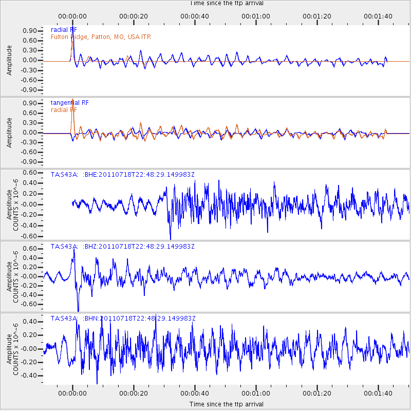
S43A Fulton Ridge, Patton, MO, USA - Earthquake Result Viewer
*The percent match for this event was below the threshold and hence no stack was calculated.
| Earthquake location: |
Rat Islands, Aleutian Islands |
| Earthquake latitude/longitude: |
51.3/178.9 |
| Earthquake time(UTC): |
2011/07/18 (199) 22:38:38 GMT |
| Earthquake Depth: |
19 km |
| Earthquake Magnitude: |
5.8 MW, 5.3 MS, 5.4 MB, 5.8 MW |
| Earthquake Catalog/Contributor: |
WHDF/NEIC |
|
| Network: |
TA USArray Transportable Network (new EarthScope stations) |
| Station: |
S43A Fulton Ridge, Patton, MO, USA |
| Lat/Lon: |
37.57 N/90.08 W |
| Elevation: |
263 m |
|
| Distance: |
62.4 deg |
| Az: |
63.741 deg |
| Baz: |
314.856 deg |
| Ray Param: |
$rayparam |
*The percent match for this event was below the threshold and hence was not used in the summary stack. |
|
| Radial Match: |
73.68974 % |
| Radial Bump: |
400 |
| Transverse Match: |
65.90514 % |
| Transverse Bump: |
379 |
| SOD ConfigId: |
401841 |
| Insert Time: |
2011-12-21 05:23:12.572 +0000 |
| GWidth: |
2.5 |
| Max Bumps: |
400 |
| Tol: |
0.001 |
|
Signal To Noise
| Channel | StoN | STA | LTA |
| TA:S43A: :BHZ:20110718T22:48:29.149983Z | 5.2402124 | 3.0842477E-7 | 5.8857307E-8 |
| TA:S43A: :BHN:20110718T22:48:29.149983Z | 2.8507273 | 2.0946719E-7 | 7.347851E-8 |
| TA:S43A: :BHE:20110718T22:48:29.149983Z | 3.2696922 | 2.5487213E-7 | 7.7949885E-8 |
| Arrivals |
| Ps | |
| PpPs | |
| PsPs/PpSs | |


