You are here: Home > Network List > UW - Pacific Northwest Regional Seismic Network Stations List
> Station YACT Amboy, WA, USA > Earthquake Result Viewer
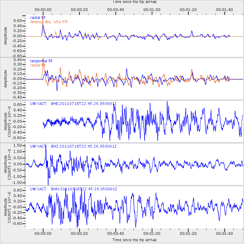
YACT Amboy, WA, USA - Earthquake Result Viewer
*The percent match for this event was below the threshold and hence no stack was calculated.
| Earthquake location: |
Rat Islands, Aleutian Islands |
| Earthquake latitude/longitude: |
51.3/178.9 |
| Earthquake time(UTC): |
2011/07/18 (199) 22:38:38 GMT |
| Earthquake Depth: |
19 km |
| Earthquake Magnitude: |
5.8 MW, 5.3 MS, 5.4 MB, 5.8 MW |
| Earthquake Catalog/Contributor: |
WHDF/NEIC |
|
| Network: |
UW Pacific Northwest Regional Seismic Network |
| Station: |
YACT Amboy, WA, USA |
| Lat/Lon: |
45.93 N/122.42 W |
| Elevation: |
211 m |
|
| Distance: |
38.2 deg |
| Az: |
74.331 deg |
| Baz: |
299.947 deg |
| Ray Param: |
$rayparam |
*The percent match for this event was below the threshold and hence was not used in the summary stack. |
|
| Radial Match: |
68.580475 % |
| Radial Bump: |
400 |
| Transverse Match: |
74.65173 % |
| Transverse Bump: |
400 |
| SOD ConfigId: |
401841 |
| Insert Time: |
2011-12-21 05:27:57.995 +0000 |
| GWidth: |
2.5 |
| Max Bumps: |
400 |
| Tol: |
0.001 |
|
Signal To Noise
| Channel | StoN | STA | LTA |
| UW:YACT: :BHZ:20110718T22:45:26.950001Z | 7.2801814 | 6.1148796E-7 | 8.3993505E-8 |
| UW:YACT: :BHN:20110718T22:45:26.950001Z | 1.8358732 | 2.0911725E-7 | 1.1390615E-7 |
| UW:YACT: :BHE:20110718T22:45:26.950001Z | 3.0753095 | 2.3679867E-7 | 7.6999946E-8 |
| Arrivals |
| Ps | |
| PpPs | |
| PsPs/PpSs | |


